Places to visit in Израиль
Almond and The Echo of the Ottoman Rail
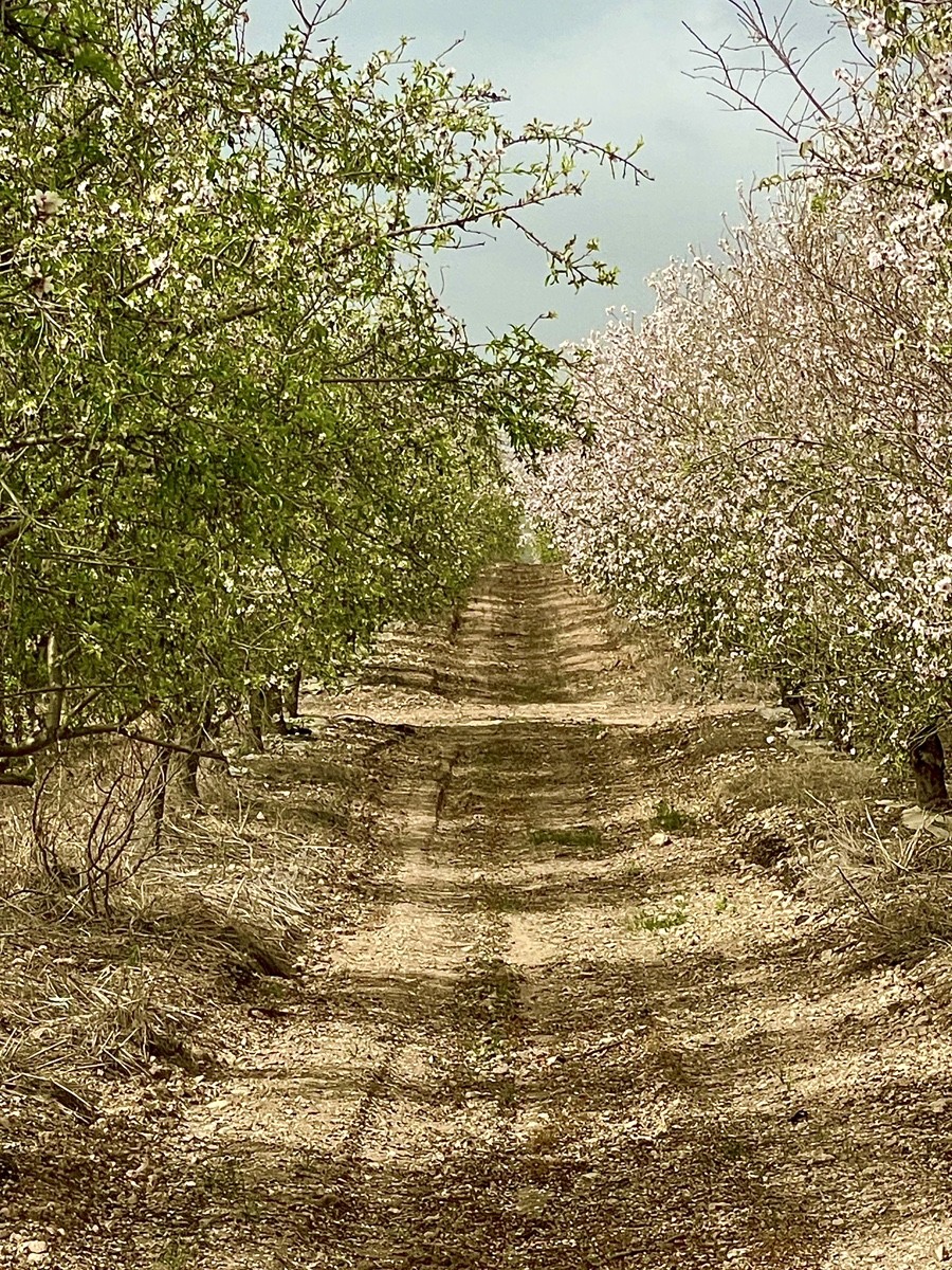
The journey begins in the almond blossoms of Sha'alvim, a landscape rooted in the biblical territory of the Tribe of Dan. The route advances through the strategic Latrun salient to Emmaus-Nicopolis, where Byzantine ruins mark the site of the Resurrection—land preserved through the spiritual visions of Mariam Baouardi and the patronage of Countess Beatrice de Saint-Cricq.
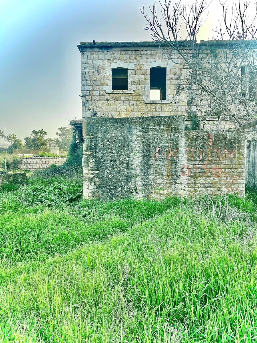
The path culminates at the abandoned Sorek Station, a limestone relic of the Ottoman Empire. Inside, time stands still among concrete staircases and iron veterans: a freight car and a yellow-marked shunting locomotive from the 1990s. A modest monument to Egyptian labourers honours the unsung builders of the WWI era. Today, the silence of these rusted tracks is only broken by the whistle of modern trains, bridging the gap between ancient faith and imperial ruins.

The Latrun Salient is a strategic high ground in the Ayalon Valley that historically dictated the flow of supplies between Tel Aviv and Jerusalem. In May 1948, following the British withdrawal, the Jordanian Arab Legion seized the Tegart fort, effectively blockading 100,000 Jewish residents in Jerusalem. Despite five or six gruelling assaults by the 7th Brigade and Alexandroni units—in which future Prime Minister Ariel Sharon was severely wounded—the fort remained impenetrable.
To bypass this stronghold, Israeli forces carved the "Burma Road" through the mountains to break the siege. Following the 1949 Rhodes Agreement, Latrun remained a Jordanian enclave surrounded by a no-man's land until the 1967 Six-Day War, when the IDF captured it in a matter of hours. Today, the blood-soaked soil of this former battlefield is home to Canada Park and Yad La-Shiryon, one of the world's largest tank museums housed in the very fort that once triggered a national crisis.
Adjacent to Canada Park lies the former No-Man's-Land, a 46-square-kilometre buffer zone once contested between Israel and Jordan. Founded in 1951 on the Green Line, Kibbutz Sha’alvim served as a dangerous frontier outpost, with its residential area in Israel but its fields bleeding into the disputed neutral strip.
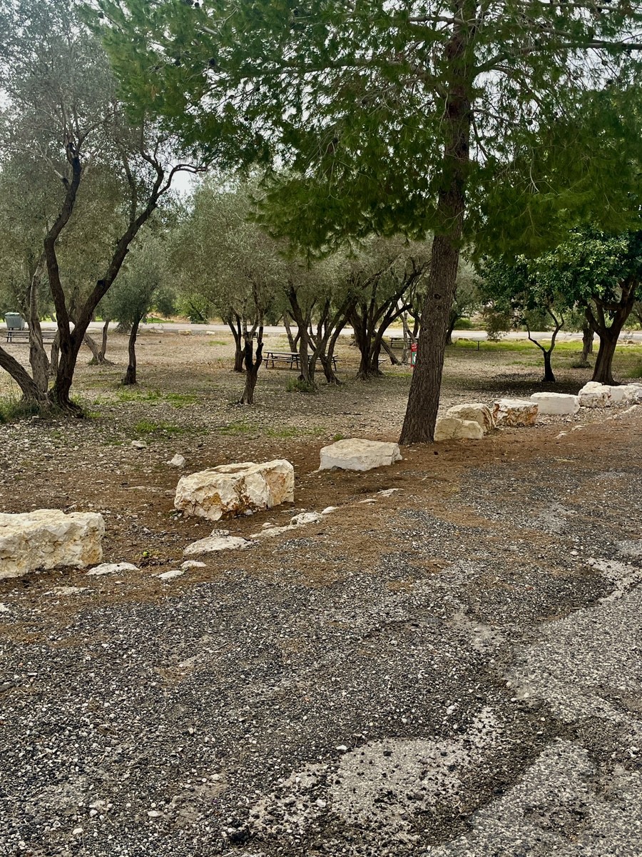
The tension peaked in 1965 during the "War of the Tractors," a territorial struggle fought with ploughs rather than guns. To secure the fertile Ayalon Valley, Kibbutz members raced to cultivate the neutral soil. The crisis led to a historic ruling by Rabbi Shlomo Goren, who permitted ploughing on the Sabbath under the principle of Pikuach Nefesh (saving a life), categorising land defence as a matter of national security. Since 1967, these once-forbidden lands have been transformed into the peaceful almond orchards and vineyards that define the landscape today.
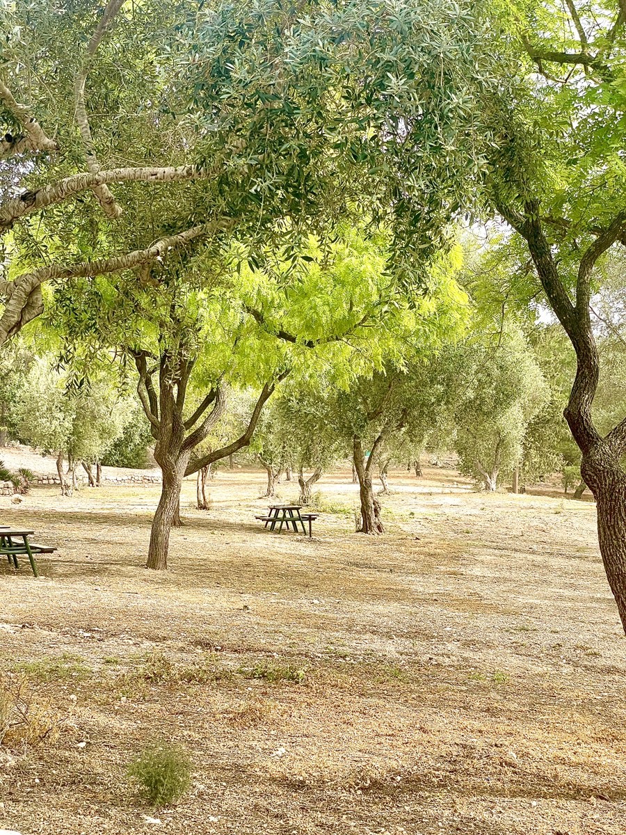
The Ayalon Valley provides the ideal climate and soil for Kibbutz Sha'alvim to maintain its primary agricultural landmark: vast almond orchards. While the kibbutz also cultivates wheat, cotton, and grapes, the almonds serve as its seasonal "calling card."
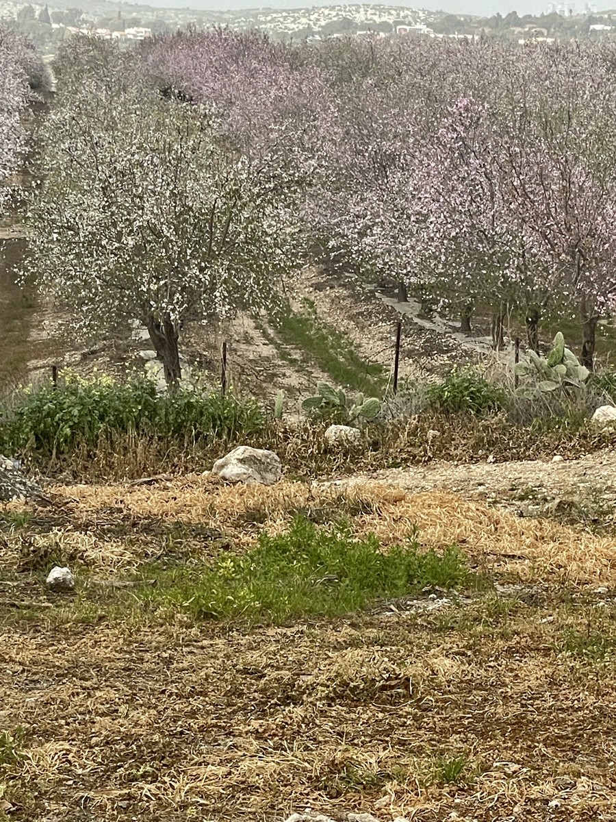
In late January and February, the hills of Latrun and Sha'alvim draw crowds of tourists and photographers to witness the landscape transformed by white and pink blossoms. These orchards often feature the "Matan" variety—a self-pollinating strain developed by Israel's Volcani Institute specifically to optimise yields in the local Mediterranean climate. This fusion of high-tech agronomy and natural beauty has turned the former frontier into a premier destination for winter blooming.
Unlike traditional almond varieties like the Californian Nonpareil, which require cross-pollination from different cultivars and active bee participation, the Israeli "Matan" variety is self-pollinating. Developed at the Volcani Institute and named after researcher Matan Hoffman, this cultivar allows a single flower's pollen to fertilise its own pistil.
This biological independence offers critical agricultural advantages: it eliminates the risk of crop failure during cold, wind-still days when bees are inactive and allows for uniform fields of high-yielding trees. The Matan variety simplifies mechanical harvesting through simultaneous ripening and produces large, sweet, soft-shelled nuts. This innovation has established Israel as a global leader in almond breeding, turning the orchards of Sha'alvim into a model of efficient, high-tech farming.
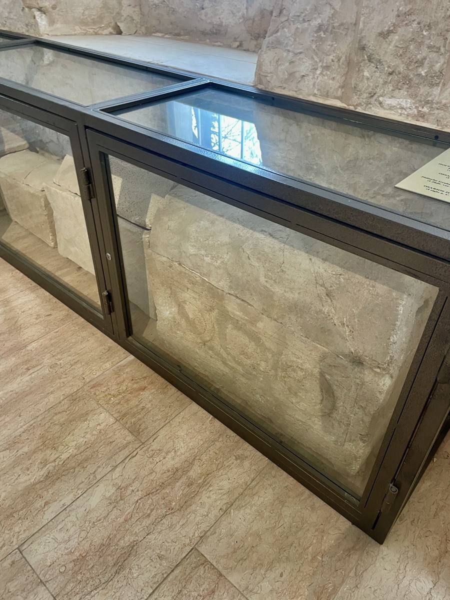
The soil of Sha'alvim serves as a literal archive of the Byzantine era (4th–7th centuries CE). What appears to be debris is actually a "household code"—fragments of pottery that ancient farmers used as fertiliser or discarded, only for erosion to wash them into today's almond orchards.
Two specific types of sherds reconstruct this lost world:
Ribbed Amphorae: Deeply grooved fragments from "Palestinian amphorae," designed to be lightweight yet durable for transporting wine and oil to coastal ports.
Kitchen Ware: Thick-rimmed cooking pots tempered with lime to withstand open flames.
These artefacts prove that the Ayalon Valley was a thriving commercial hub long before modern borders. Holding these fragments offers a tactile connection to the daily lives of Byzantine settlers who worked the same earth 1,500 years ago.
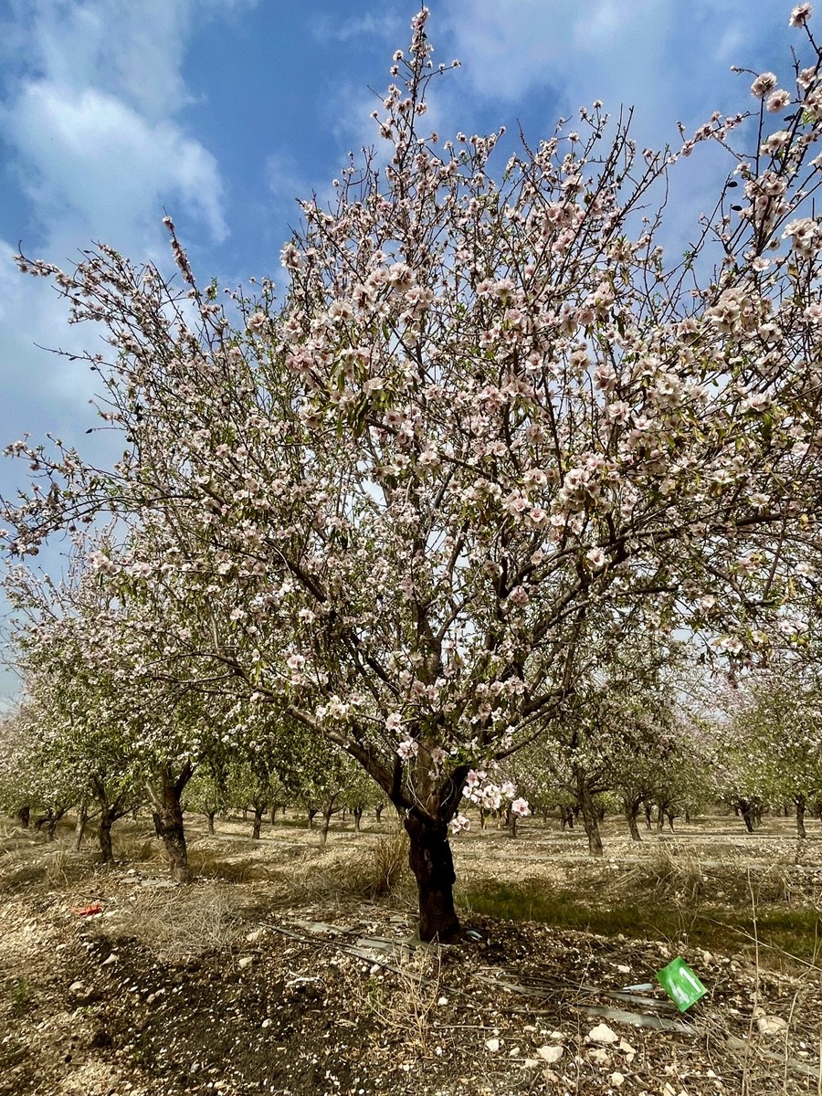
The visual contrast between snow-white and pale-pink almond blossoms in the Ayalon Valley is determined by a genetic "dress code." Commercial varieties like the Nonpareil lean toward pure white, while Israeli hybrids like Matan often display a rosy hue, particularly in early bloom.
A single flower also acts as a biological signal through colour shifts:
Fresh Blooms: Deep pink petals signal peak nectar and pollen to insects.
Mature Blooms: Once pollinated, pigments (anthocyanins) fade, turning the petals white.
The intensity of these colours is influenced by the season; a sharp transition from a cold winter to spring can heighten the concentration of pink. For those wandering the former No-Man's Land, the Wild Almond (Prunus dulcis) stands out with vivid crimson or deep magenta blossoms, far more intense than its cultivated "pale" relatives. To capture the most vibrant pinks, photographers must arrive in late January before the orchards transition to their mature, white state.

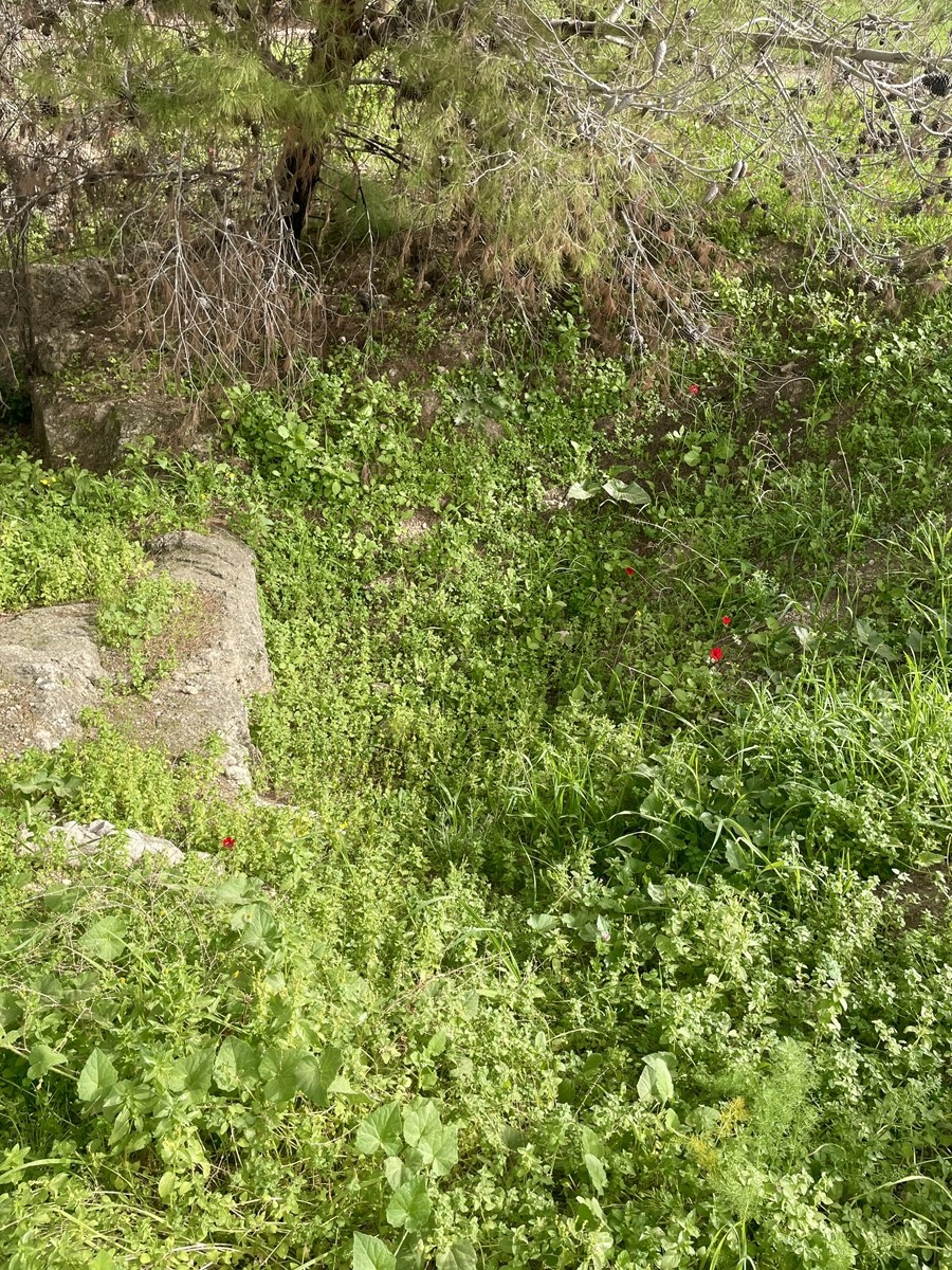
The vegetation of the Latrun Salient serves as a biological archive, demarcating the former Green Line and the scars of its history. Sabra cacti (Opuntia) act as living fences, marking the perimeters of abandoned villages and ancient property lines. In contrast to the orderly, pale rows of Kibbutz Sha'alvim, the vivid pink of wild almond trees highlights old terraced gardens and the once-untouched soil of No-Man's Land.
Dominating the landscape is the Mount Tabor Oak, whose ancient branches once served as vantage points for snipers and observers along the border. Meanwhile, dense thickets of wild asparagus and ephedra drape over stone ruins, acting as natural camouflage for old hidden paths. Standing on the edge of the kibbutz fields, one witnesses a stark visual dialogue: the precision of modern Israeli agriculture on one side, and the rugged, "rebellious" flora of the former buffer zone on the other—a landscape where nature and war are inextricably woven together.
From the 16th century, the village of Imwas (ancient Emmaus) functioned as a typical fellahin settlement within the Ottoman District of Ramla. According to the 1596 Defters (tax registers), the village supported 45 Muslim families through the cultivation of wheat, barley, and fruit. By the mid-1800s, the population had risen to 1,000, and the village became a site of early archaeological interest when Carmelite nuns purchased the Byzantine ruins in 1878.
The 20th century brought rapid geopolitical shifts. In late 1917, Imwas became a battlefield between the British Egyptian Expeditionary Force and the Ottoman 7th and 8th Armies. Under the British Mandate, its strategic location on the Jaffa-Jerusalem road spurred growth; census records show a population increase from 824 in 1922 to over 1,000 by 1931. By the end of the Mandate, the village’s transition from a quiet agrarian community to a key enclave in the Latrun salient set the stage for its pivotal role in the 1948 conflict.
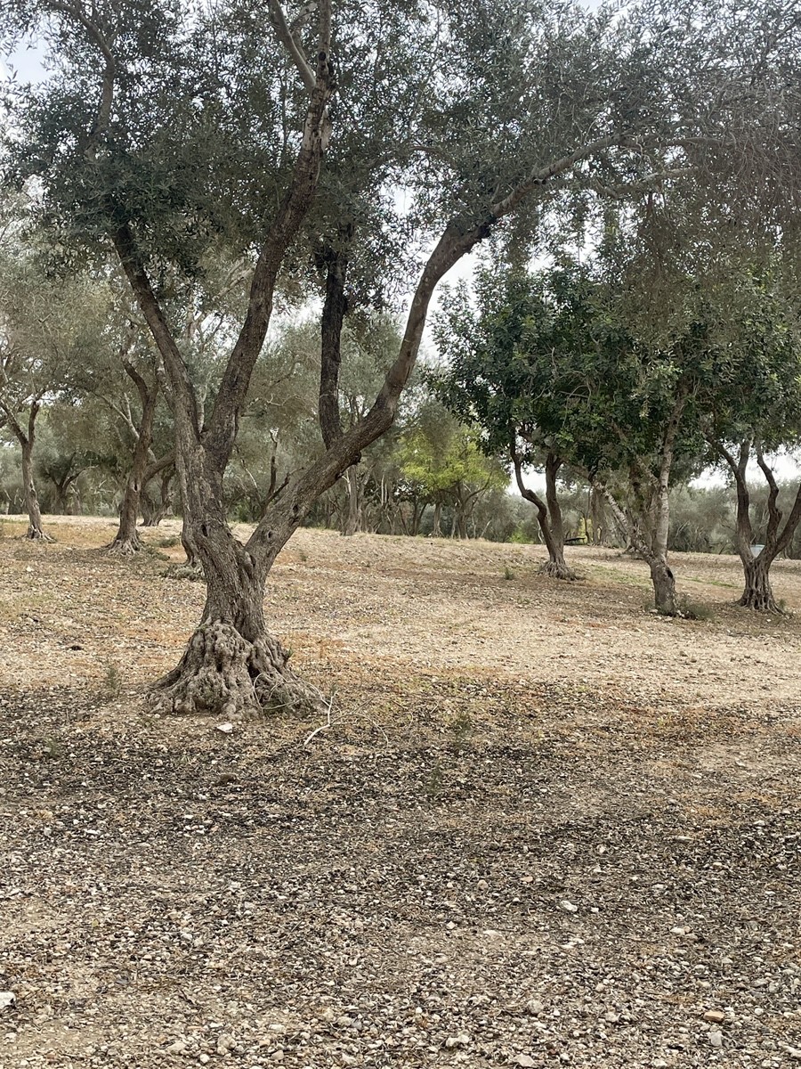
For centuries, olive groves were the economic and social bedrock of Imwas. By 1945, over 600 dunams were dedicated to the "Nabali" variety, prized for its high oil content and drought resistance. The harvest, or jada, was a collective ritual that used traditional stone presses to crush olives and filter them through woven baskets.
Strategically located between the coast and Jerusalem, Imwas served as a vital trade hub. High-quality oil was sold in Jaffa and Jerusalem—often marketed to pilgrims as a "sacred" product of biblical Emmaus—while lower-grade oil supplied the soap factories of Nablus. Throughout the Ottoman and British periods, these groves were more than individual assets; they were often waqf (blessed) property owned by entire family clans (hamulas). To maximise the land, farmers practised intercropping, growing grains between the ancient trees, a method that sustained the village until the mid-20th century.
By 1948, Imwas, along with the neighbouring villages of Yalo and Beit Nuba, had become the cornerstone of the Latrun Salient. Its elevated position overlooking the main artery to Jerusalem allowed the Jordanian Arab Legion and local militias to impose a deadly blockade on thecity'ss Jewish residents. Despite repeated Israeli attempts to capture the area during operations Bin-Nun A and B, Imwas remained a Jordanian stronghold just hundreds of meters from the Green Line.
For the next 19 years, the village was viewed by Israel as a source of"strategic hostility." It served as a base for infiltrations and a constant military threat to Highway 1. During the 1967 Six-Day War, the IDF captured the village with minimal resistance as Jordanian forces retreated. However, the subsequent decision to completely demolish the village was driven by a military imperative: to prevent any return of residents and to permanently secure the narrow transit corridor to Jerusalem, ensuring the"strategic thor" was removed once and for all.
On June 6, 1967, the strategic threat of the Latrun Salient reached its peak when elite Egyptian commandos used the area to target Israeli airbases. Following intense combat—which left 80 Egyptian soldiers buried in a mass grave near what is now Mini Israel—the Israeli military leadership, including General Yitzhak Rabin, ordered the immediate and total demolition of Imwas, Yalo, and Beit Nuba.
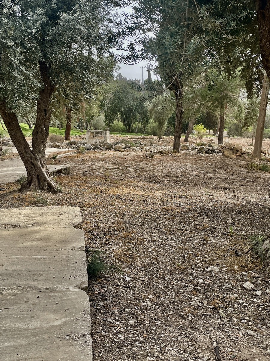
Residents were given mere minutes to flee toward Ramallah as bulldozers systematically levelled schools and homes. To finalise the area's status and prevent any legal return of the inhabitants, Canada Park was established in the early 1970s. While ancient Byzantine ruins and cemeteries were spared, the village's domestic history was buried under new forests, leaving only the original olive groves as silent witnesses to the pre-1967 landscape.
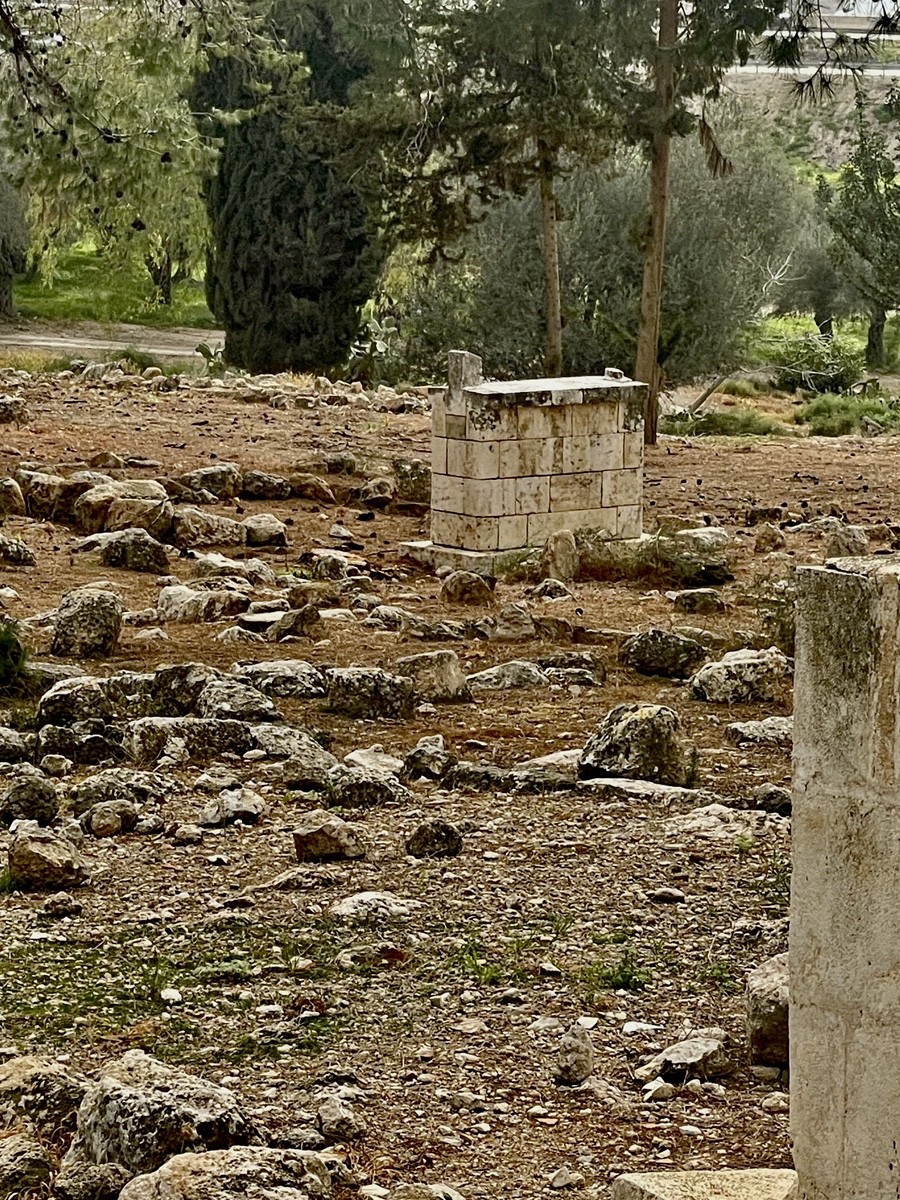
The Maqam of Sheikh Mualla stands as one of the few structures spared by bulldozers in 1967, reflecting a military policy to avoid destroying religious sites. While the current building dates to the Late Ottoman period, local tradition venerates the Sheikh as a patron saint from the 7th-century Arab conquest. Before the village’s destruction, residents gathered here to pray for healing and divine intercession.
The maqam is inseparable from the surrounding cemetery and the memory of the Plague of Amwas (639 CE). This catastrophic epidemic claimed the lives of thousands of early Islamic soldiers, including companions of the Prophet Muhammad. This historical weight confers profound sanctity on the entire site, preserving the spiritual identity of Imwas even after its physical disappearance.
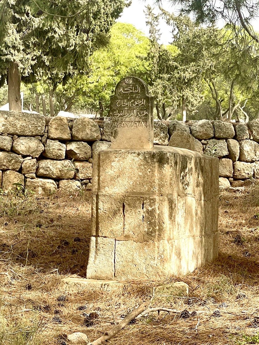
Among the remnants of the Imwas cemetery stands the tombstone of Hajj Abd al-Aziz al-Ghoul, a prominent member of one of the village's most respected clans (hamulas). The title "Hajj" signifies his completed pilgrimage to Mecca, while his surname links him to a family of landowners who for generations cultivated the olive groves of the Ayalon Valley.
In June 1967, the Al-Ghoul family was displaced within hours, joining the 2,000 residents forced toward refugee camps in the West Bank and Jordan. Because Israeli engineering units spared religious sites and graves during the demolition of the village, this headstone remains one of the few physical proofs of the family's presence. Today, the cemetery serves as a rare point of return, where descendants are occasionally permitted to gather to honour the ancestors whose labour once defined the local economy.
A distinct botanical divide defines the landscape of Canada Park. Alongside the ancient olives and sabra cacti—relics of the Palestinian village of Imwas—stands the Black Locust (Robinia pseudoacacia). Unlike the historic groves, these "acaci"s" were" intentionally planted after 1967 to provide rapid shade for modern picnic areas.
As a hardy "pioneer"r species, the obinia thrives in the poor, rocky soil left behind by the demolition of village structures. Its roots now stabilise the very slopes where houses once stood, serving as a functional tool of Israeli afforestation. While the olives represent the agrarian past, the Robinia and pines symbolise the site's conversion into a recreational zone, effectively anchoring the park’spark'smporary identity over the ruins of the old.
Established in the early 1970s by the Jewish National Fund (KKL) with funding from the Canadian Jewish community, Canada Park was designed to provide a recreational space while strategically securing the Latrun Salient. By replacing the ruins of Imwas, Yalo, and Beit Nuba with forests, the project aimed to prevent the re-establishment of Arab settlements along the vital road to Jerusalem.
This transformation remains deeply controversial, with critics arguing that the forest serves to "veil" the history of the displaced villages. The tension escalated in May 2025, when massive forest fires—classified by authorities as nationalistic arson—devastated dozens of hectares during Independence Day. These acts are viewed as a "struggle for the landscape," an attempt to strip away the symbolic Israeli forest to reveal the underlying ruins. In response, 2026 has seen a surge in security measures, including drone surveillance and cameras, to protect this fragile synthesis of nature and geopolitics.
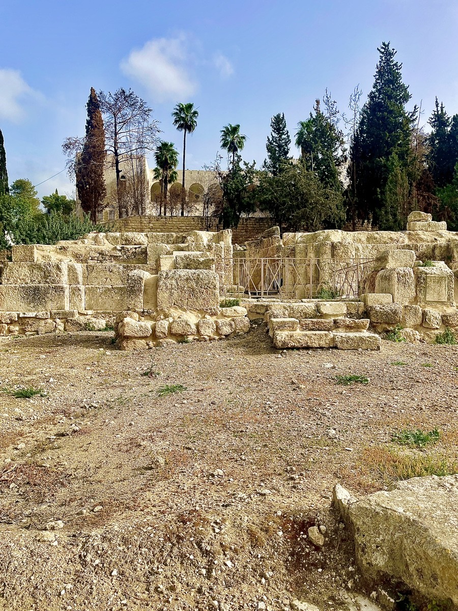
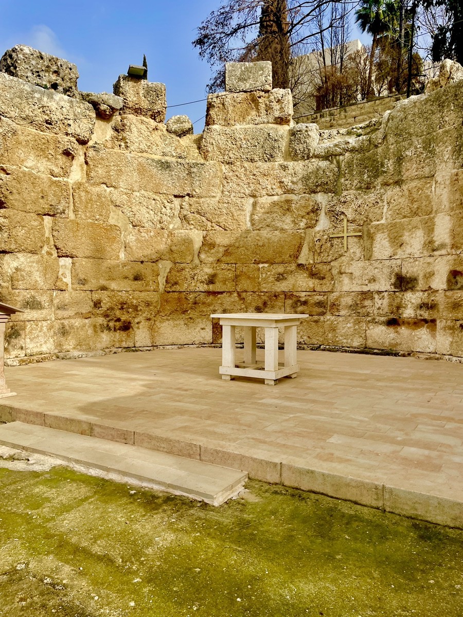
The ruins of Emmaus-Nicopolis present a stark architectural timeline: the massive, rough-hewn blocks of a 5th-century Byzantine basilica form the foundation, upon which 12th-century Crusaders built a smaller, fortress-like church. In the background stands the 19th-century monastery, established after the mystic Mariam Baouardi identified the site as the biblical Emmaus.
Unlike the surrounding village of Imwas, this complex remained untouched during the 1967 conflict due to strict military orders to preserve archaeological and religious sites. This "immunity" was tested again during the nationalistic arson of 2025; while the pine forests of Canada Park burned fiercely, the ancient limestone walls and the irrigated monastery gardens acted as a natural firebreak, sheltering the mosaics and altars from the flames once more.
The elevation of Emmaus to the status of Nicopolis ("City of Victory") in 221 CE was a triumph of personal diplomacy. Julius Africanus, a Christian scholar and librarian to Emperor Heliogabalus, leveraged his imperial influence to secure city status and minting rights for his "small homeland." By the 5th century, this Roman administrative centre became a Byzantine episcopal seat, anchored by one of the region's largest cathedrals.
The site's mosaics provide a rare chronological anchor: a found cross motif on the floor predates the 427 CE imperial edict banning sacred symbols on pavements to prevent them from being stepped on. Today, the ruins remain a "living" sanctuary maintained by the Community of the Beatitudes. Pilgrims still gather among the ancient stones for the liturgy of the "Breaking of Bread," physically reenacting the Gospel narrative of the Resurrection on the very site Julius Africanus once championed.
The small square rock-cut entrance marks a Jewish tomb from the Second Temple period, a time when the settlement was known as Hammat. Derived from the Hebrew root for "hot" (ham), the name reflected the local thermal springs. As a prominent administrative centre (toparchy) of Judea, the town's identity shifted with its conquerors.
The Greeks and Romans, unable to preserve the Semitic guttural "H," adapted the name into Ammaus or Emmaus—the version immortalised in the New Testament and the chronicles of Josephus Flavius. Following the Arab conquest in the 7th century, the name reclaimed its guttural depth, evolving into Imwas. This linguistic cycle, spanning two millennia, remained the village's identity until its destruction in 1967, tracing a path from ancient Hebrew roots to Hellenistic adaptation and back to Semitic phonetics.
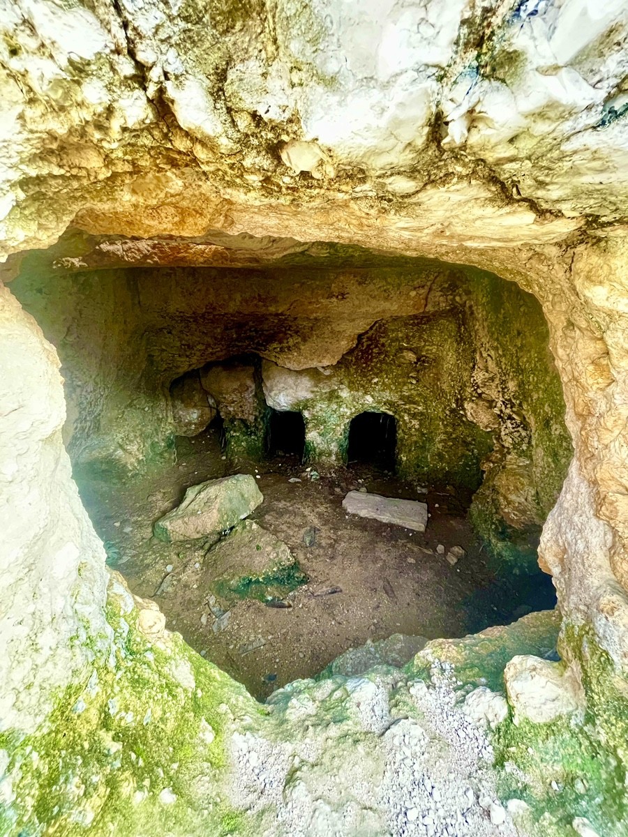
The limestone hills of Hammat (ancient Emmaus) are honeycombed with Jewish rock-cut tombs from the Second Temple period. These structures featured narrow entrances for rolling stones (golel) and deep kokhim (niches) for primary burial, reflecting the high status of the town's residents.
Across two millennia, this land has been a theatre of war for Romans, Crusaders, Ottomans, and modern armies. Yet, a remarkable continuity persists: while houses and fortifications were repeatedly levelled, the cemeteries—both ancient Jewish tombs and the Muslim graves of Imwas—remain largely untouched. This "unwritten rule" of not warring with the dead has turned Canada Park into a unique space where burial grounds of conflicting eras coexist. In a region of extreme political and military turbulence, the sanctity of the grave has proven stronger than the impulse to destroy, preserving the only physical link to the generations who once called this valley home.
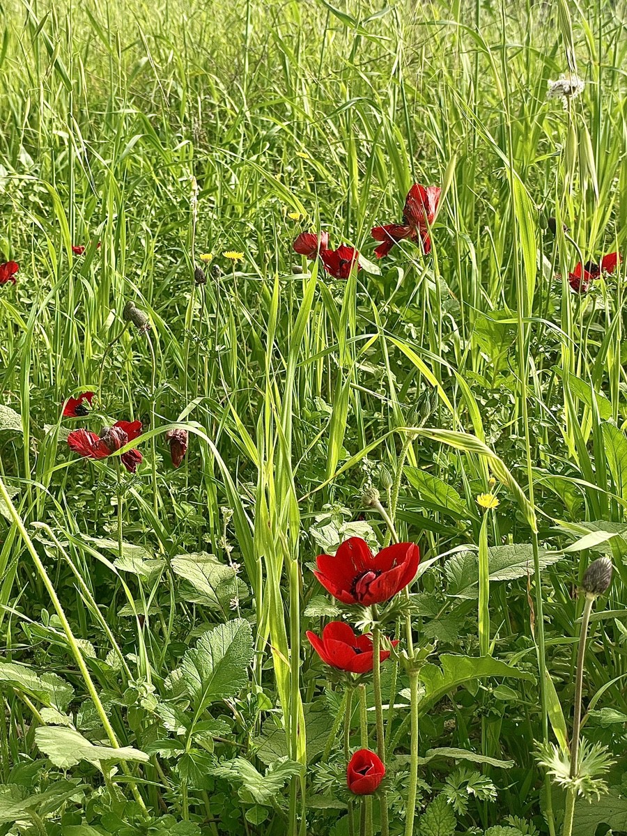
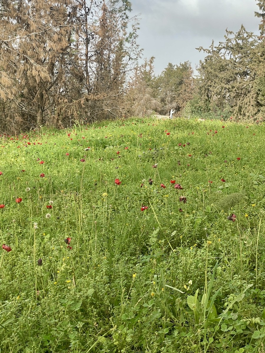
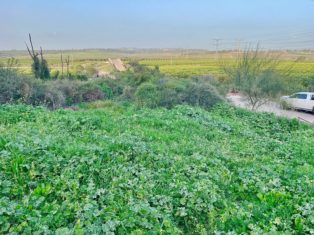
The Shphelah foothills are defined by the vibrant contrast of Anemones (Kalaniyot)—the iconic red symbol of the Israeli winter—blooming amidst lush grasses and wild mustard. This verdant landscape is fleeting; as summer approaches, the valleys quickly transition from deep greens to golden browns.
In 2025, this delicate ecosystem was tested by devastating fires that consumed significant portions of the coniferous forests. However, the ancient olive groves and the limestone tombs of Hammat proved resilient, surviving the flames to maintain the unique character of the Latrun Salient. The enduring presence of these historical and botanical landmarks underscores a cycle of destruction and rebirth that has defined this territory for millennia.
The landscape of Latrun and Canada Park is a classic representation of the Shfela—the Judean Foothills, serving as a transitional buffer between the coastal plain and the Jerusalem Mountains. These soft, rounded hills are composed of Meleke limestone and chalk, covered in a carbonate-rich rendzina soil that is perfectly suited for the region's historic olive groves and vineyards.
The geography is defined by broad, fertile valleys, such as the Ayalon Valley, which historically served as both a breadbasket and the primary gateway to Jerusalem. This natural "granary" is framed by 20th-century afforestation, in which pines and cypresses were introduced to transform abandoned terrains into shaded parklands. The intersection of this strategic topography and its productive soil explains why this specific corridor has remained a focal point of human ambition from biblical times to the present day.
The modern presence in Emmaus-Nicopolis is a product of the 19th-century European movement to reclaim Christian holy sites in the Ottoman Empire. Central to this story is Mariam Baouardi (Saint Mary of Jesus Crucified), a Carmelite nun who, in 1878, claimed a divine revelation identifying the ruins of Imwas as the authentic biblical Emmaus.
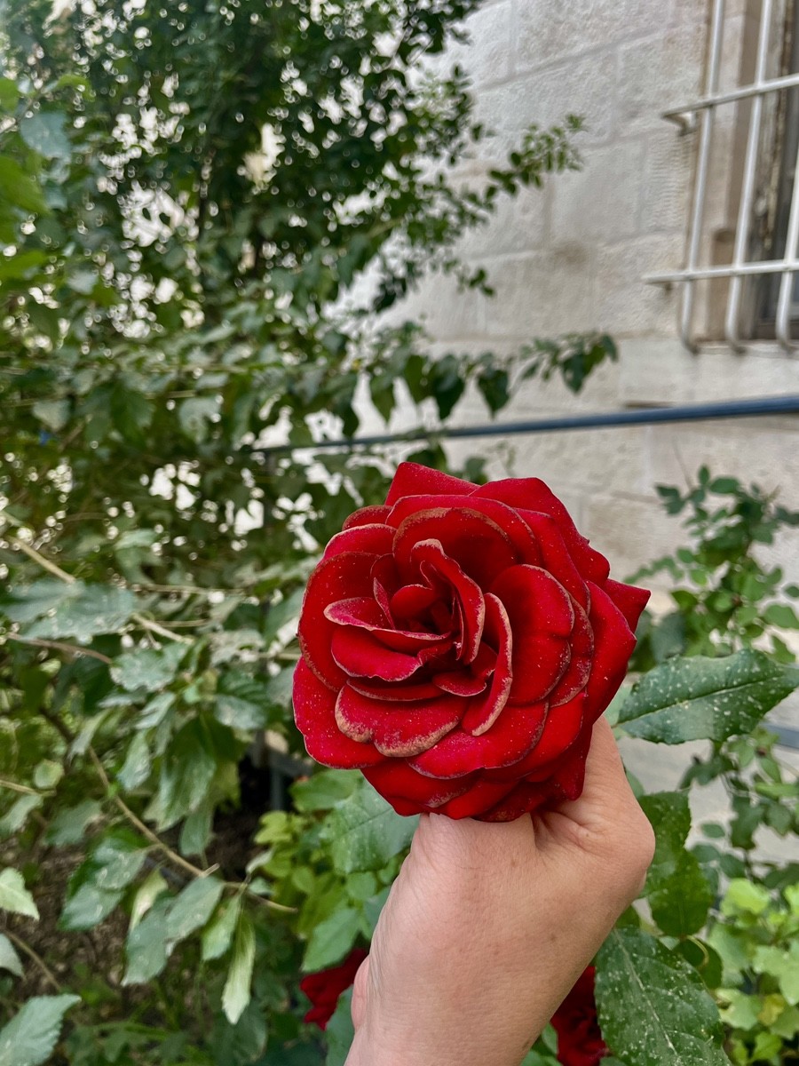
Her vision prompted French benefactors and the Latin Patriarchate of Jerusalem to purchase the land, sparking a century of professional archaeological work by the École Biblique. They uncovered the Byzantine mosaics and the foundations of the grand basilica, transforming a fellahin village into an international pilgrimage site. Since 1993, the complex has been maintained by the Community of the Beatitudes, a Catholic movement that bridges monastic and lay life. Today, the monastery stands as the only inhabited "island" amidst the former village ruins, where carefully tended rose gardens and multilingual plaques serve as a living link between ancient tradition and modern faith.
The restoration of Emmaus-Nicopolis is the unlikely result of a 19th-century romantic tragedy. In 1828, a young Franz Liszt fell in love with his pupil, Caroline de Saint-Cricq, but her father—a French minister—forbade the union due to Liszt's lower social status. This heartbreak eventually led Caroline's daughter, Bertha de Saint-Cricq, to Pau, where she encountered Mariam Baouardi, a Palestinian Carmelite nun with a miraculous past.
In 1878, guided by Mariam's visions of the "true" biblical Emmaus at Imwas, Bertha dedicated her family's massive fortune to purchasing the land. After Mariam's untimely death, Bertha sold her French estates, moved to Jerusalem, and funded the first scientific excavations under Captain Joseph-Bernard Guillemot, which revealed the Byzantine basilica. Today, the names of Liszt, the saintly Mariam, and the devoted Countess Bertha converge at this single point in the Ayalon Valley, where Bertha remains buried among the stones she sacrificed her inheritance to save.
The Wadi Sarar (Nahal Sorek) station serves as a grim monument to the unsung backbone of the British Empire: the Egyptian Labour Corps and Indian supply units. In late 1917, these men were the "living conveyor belt" that laid the tracks toward Jerusalem. For the Empire, they were mere workforce; for the winter, they were prey. Dying not from bullets but from the lethal combination of hunger, exposure, and the freezing rains of the Judean Hills, they were often buried without names—recorded only as numbers in a colonial ledger.
The modest limestone pyramid standing there today is a rare intersection of histories. Topped with the Shahada in elegant Arabic script, it commemorates 112 Egyptians and 7 Indians—the documented few among thousands who perished. The brutal treatment of these labourers, many of whom were forcibly conscripted through village headmen (omdas), later became the spark for the 1919 Egyptian Revolution. Restored in 2021 by Indian and CWGC delegations, the stone stands as a silent witness to the moment when the "numbers" finally reclaimed their place in the Sorek Valley landscape.
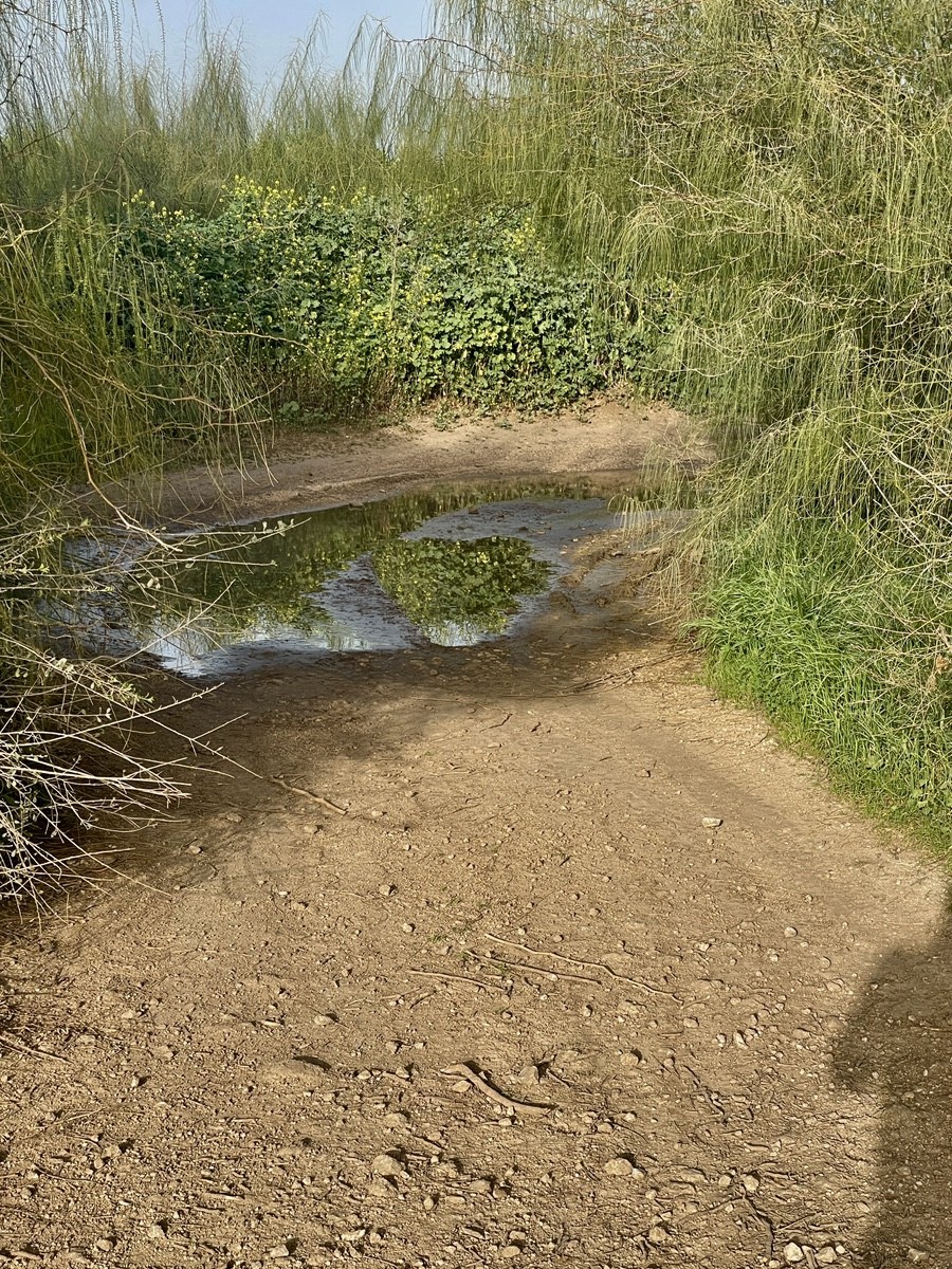
The path to Wadi es-Sarar—named for the "pebbles" lining the streambed—is a walk through layers of history. This landscape is also the biblical Nahal Sorek, the valley of Samson and Delilah, named after a superior red grape variety. In the late 1880s, this ancient terrain became the site of an engineering marvel: the first railway connecting Jaffa to Jerusalem.
Conceived by Jewish entrepreneur Yosef Navon and realised with French capital and Ottoman concessions, the line used a narrow 1000mm gauge to navigate the treacherous ascent into the Judean Hills. While initially a humble waypoint, the station's fate changed in 1915 during World War I. German and Ottoman engineers transformed it into the vital "Junction Station," constructing a strategic southern branch toward Be'er Sheva to challenge the British for control of the Suez Canal. What was once a pastoral valley of vineyards became the most critical military-transport hub in the Middle East.
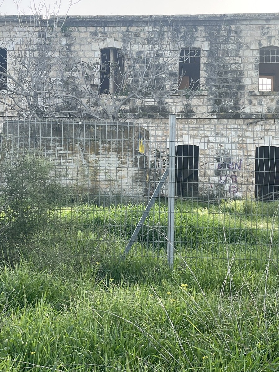
The station building at Wadi es-Sarar (Junction Station) is a quintessential example of late 19th-century Ottoman railway architecture. Now a majestic ruin lost in tall grass, the two-story structure is built from massive blocks of Jerusalem limestone. Its design is defined by a sturdy lower tier of rough-hewn stone and an upper level featuring the characteristic arched windows and doorways typical of the period.
The weathered façade, stained with the patina of time and dampness, tells a story of lost prestige. Historically, the ground floor served as the functional heart of the station—housing the waiting room, ticket office, and telegraph—while the upper floor provided living quarters for the station master and his family. Today, the empty window frames and hollow interior give the building the appearance of a stone skeleton, standing as a silent witness to the era when the steam engine first conquered the Judean wilderness.
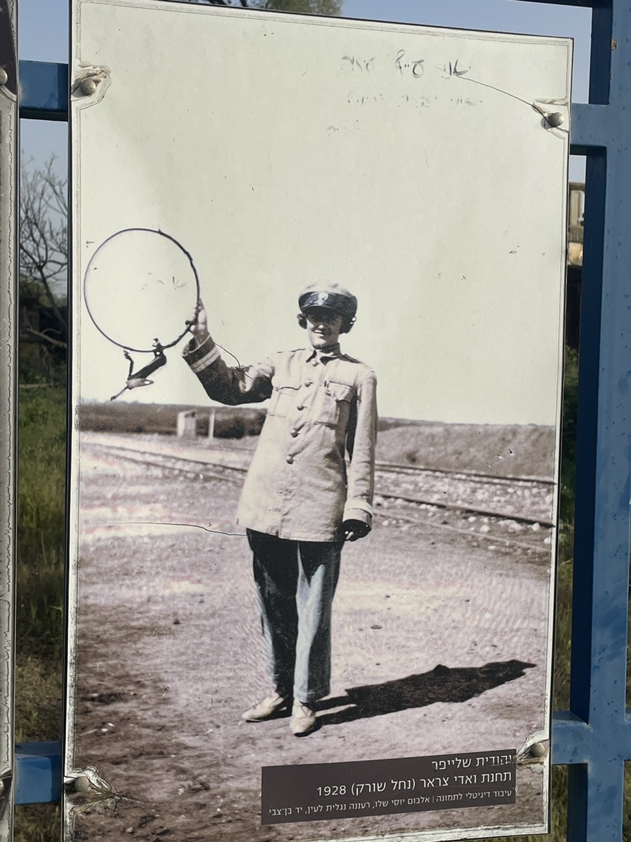
The modern era of Wadi Sarar (Nahal Sorek) opened with a decisive night assault in November 1917, when Indian Rifles seized the junction, severing Ottoman supply lines to Jerusalem. By 1927, the station became home to Yehudit Schleifer and her husband, a railway inspector. Living in the station master's house, they existed within the rigid safety of the "Staff" system. This physical metal wand served as the only guarantee against head-on collisions on the single-track line.
However, Yehudit led a double life as a member of the Haganah. Exploiting her status as a railway wife, she facilitated the transport of weapons hidden in coffins through the station. Her life and the railway were inextricably linked; in 1928, when a passing express train was halted to take her to the hospital, her son Yair was born within the station walls before the train could depart. In 2019, her descendants installed a memorial plaque, ensuring that these stories of birth and resistance are not lost to the encroaching tall grass.

The history of Palestine's railways is a chronicle of a remote province transforming into a strategic global hub. The tracks at Nahal Sorek bear the "scars" of three distinct eras:
The Ottoman Ambition (1890–1914): Early lines were driven by prestige and pilgrimage. The Jaffa-Jerusalem (J&J) line (1892) was a private French venture that used a narrow 1000mm gauge to conquer the Judean Hills, reducing a two-day wagon journey to just four hours.
The Great War Race (1914–1918): Railways became weapons. To strike the Suez Canal, Ottoman and German engineers built a southern branch from Wadi Sarar toward Be'er Sheva, even cannibalising rails from the J&J line. When the British captured the junction, they converted the network to the Standard European Gauge (1435mm), physically integrating Egypt and Palestine.
The British Mandate Golden Age (1920–1948): Under Palestine Railways (PR), the "Life Line" from Haifa to Cairo allowed seamless travel from the Levant to Africa. While it was a period of modernisation and the region's largest employer, the network eventually became a target of underground resistance (Haganah, Etzel, Lehi), culminating in the dramatic "Night of the Bridges."
Wadi Sarar was the literal heart of this evolution—the decision point where a train would turn either toward the pyramids of the South or the holy sites of the East.
Among local history enthusiasts, a persistent legend lingers. During the frantic Ottoman retreat in 1917, a wagon or supply train carrying the administration's wealth was allegedly abandoned or buried near Junction Station. While no "Turkish gold" has ever been found, the myth adds a layer of mystery to the ruins.
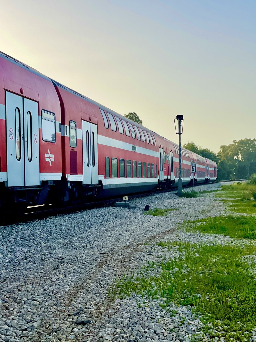
In Israeli culture, Nahal Sorek Station has become a symbol of the "forgotten frontier." Unlike the polished, commercialised restorations of Jaffa or Jerusalem's "First Station," time here has truly stood still. It is a sanctuary for urban explorers and photographers, offering the raw authenticity of weathered stone without the intrusion of modern cafes or fresh paint. Standing where Yehudit Schleifer and the Indian Rifles once stood, the station has retired from its strategic mission. It remains a "quiet centre"—a point of assembly for three nations where the only sound left is the wind whistling through its limestone arches.
Geographically, the station sits at the "Gateway to the Valley," but its impact went far beyond mere location. Wadi Sarar is a prime example of a "technogenic" landscape, where the natural environment was forcibly reshaped to serve the iron horse.
To protect the tracks from the fierce winter floods of the Sorek stream, 19th-century engineers didn't just build alongside nature—they altered it, diverting the stream's natural course. As you walk the grounds today, you aren't seeing the valley as it existed 150 years ago; you are witnessing a landscape designed by architects and surveyors. The very curves of the earth and the flow of the water here are silent monuments to the industrial ambition that prioritised the reliability of the Jerusalem line over the original contours of the terrain.
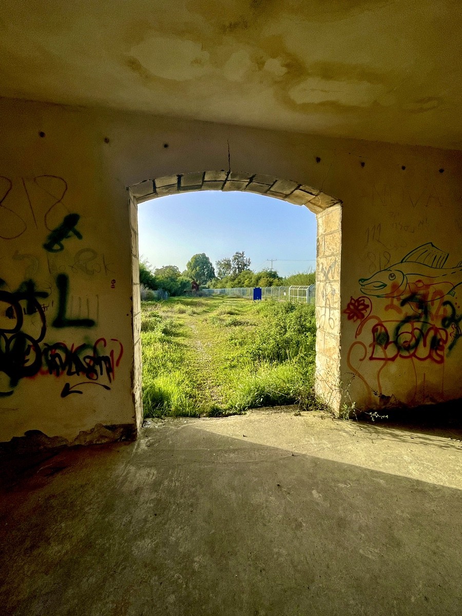
The ceiling structure visible in the ruins—known as Filler Joist construction—marks a pivotal shift in Levantine engineering. Mass-produced in Europe and the US during the late 19th century, this method reached Palestine through high-calibre artisans like the Templers and, crucially, through French and British railway engineers.
By replacing traditional vaulted stone or rot-prone wooden beams with industrial steel, architects achieved flatter ceilings, faster construction times, and the ability to span large waiting halls without massive supports. For a strategic hub like Sorek, steel was chosen not just for its strength but also for its fire resistance—a critical safety requirement for railway buildings in the era of steam and sparks. The exposed beams today are the "industria" skeleton of the station, representing Palestine’s architecture, which moved from the artisanal to the modern.
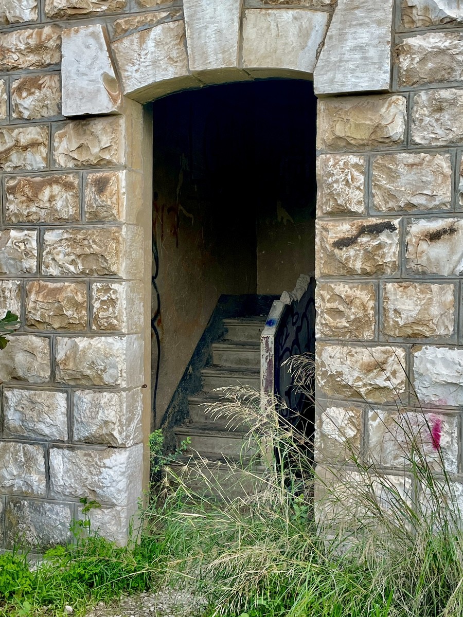
The interior staircase of the Sorek Station is a masterpiece of industrial durability. Designed to withstand the relentless traffic of soldiers, pilgrims, and heavy luggage, the stairs are crafted from monolithic reinforced concrete—a high-quality luxury material for the late Ottoman and Mandate eras. Even after decades of neglect, the steps retain their sharp geometry, a testament to the superior cement used in their construction.
The engineering is remarkably clever: each step features a projecting "bullnose" edge to prevent chipping and increase foot surface, while the two-flight compact design maximises ground-floor space for waiting halls. Though the steps appear to "float," they are deeply anchored into the massive limestone walls, providing immense structural integrity. To ensure fire safety and "vandal-proofing" at this vital military junction, the architects opted for solid concrete parapets instead of fragile wood or costly wrought iron. These stairs remain the "concrete spine" of the building, outlasting the very empire that commissioned them.
The most significant artefact of Wadi Sarar remains perched above the classic balustrades of the upper balcony: a decorative Ottoman cartouche featuring elegant Arabic calligraphy. This "signature" confirms that while the station reached its strategic peak under British rule, its soul and foundation were laid under Sultan Abdul Hamid II.
The visual contrast is striking—the massive, rusticated stone masonry represents strength, while the delicate balusters and the carved cartouche speak to the imperial prestige of the Jaffa-Jerusalem line. This stone seal acts as a silent witness to the shifting world orders, from the twilight of the Ottoman Caliphate to the British Mandate and the modern State of Israel. Today, this emblem of faded majesty is slowly being reclaimed by wild greenery, standing as a poignant reminder of an empire that once connected these hills to the wider world.
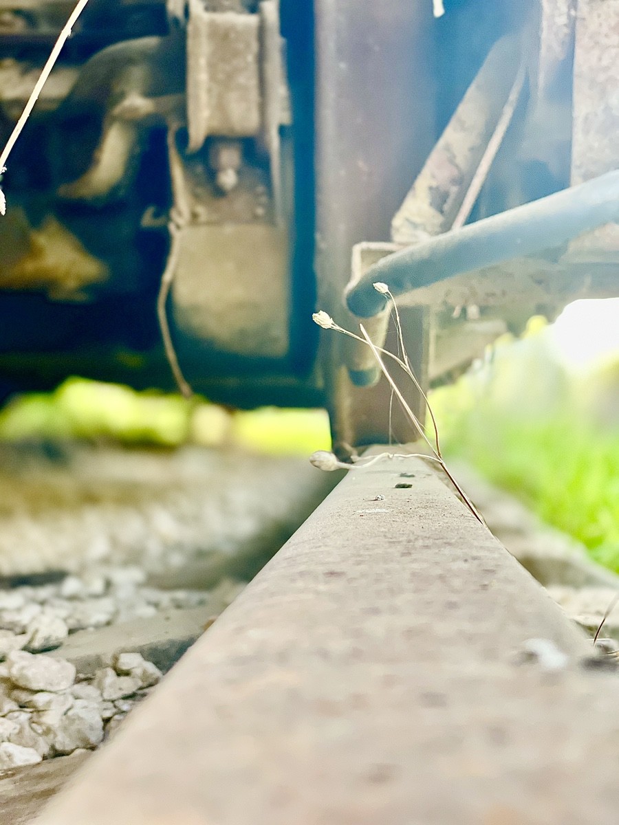
Resting on a "permanent anchor" at Sorek Station is a classic G-type covered goods wagon, a true veteran of the rails. Likely manufactured by British firms such as the Gloucester Railway Carriage and Wagon Company or European factories in the mid-20th century, these wagons were the backbone of regional logistics from the 1940s through the 1980s.
With its riveted metal skin and high-set ventilation slats—designed for transporting perishables or livestock—this wagon is a relic of the transition from steam to early diesel power. No longer carrying cargo to Jerusalem or Cairo, it has become a canvas for graffiti and a prime object of industrial archaeology. It serves as a haunting reminder of an era when logistics were slower and more tactile, often finding a second life as a makeshift warehouse on remote platforms like this one after its active service ended.
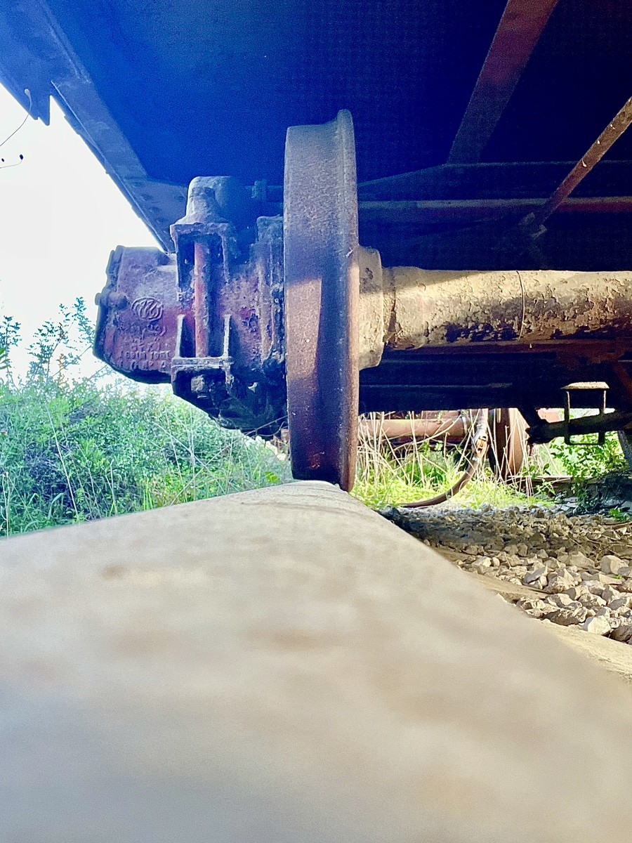
Standing in silent contrast to the high-speed trains of modern Israel is this veteran shunting locomotive (likely a G12 series or a similar British/German model). For decades, these "workhorses" were the lifeblood of Sorek Station, tirelessly marshalling wagons and providing the logistical flexibility required for such a vital junction.
The locomotive features buffers and chain couplings—a manual, labour-intensive technology that required a shunter to work dangerously between the cars. The visual of its fading yellow safety paint surrendering to deep, textured rust serves as a powerful metaphor for the 1970s and 80s infrastructure. Once the centre of all activity, this machine now stands as an industrial monument, watching from the sidelines as modern electric fleets rush past on the main lines toward Jerusalem, oblivious to the manual grit that once built this route.
For the historian, Sorek Station is a vivid illustration of the region's "transportation revolution." At the dawn of the 20th century, it was a thrumming centre of life where steam locomotives paused to replenish water from massive cisterns—the ruins of which still dot the area. Today, the station has transitioned from a vital artery into a site of Industrial Decay.
It has become a sanctuary for photographers, drawn by the stark sensory contrasts of the landscape: the cold, unyielding steel of the rails, the sharp grit of the ballast, and the "warm," porous texture of the ancient Jerusalem limestone. This interplay of materials tells the story of an era that outlived its utility but refused to vanish. Sorek stands not as a museum, but as a living canvas where the industrial ambition of the past is slowly being softened by the elements, creating a hauntingly beautiful monument to the age of steam.
