Places to visit in Рим
Rome: Esquiline, Palatine, and Everything That Lives Between Them
Rome rises on seven hills, and this walk takes us across two of its most revealing ones — Esquiline and Palatine. The Esquiline, once the city’s eastern edge, still carries traces of imperial gardens, hidden nymphaea, magical gates, and traditions that survived the fall of the empire. The Palatine, the hill of the emperors, preserves stadiums, palaces, terraces and views where the entire history of Rome — Republic, Empire, Middle Ages, Baroque and modern Italy — lies in a single panorama. Along the way, we meet the monuments, streets and layers we uncovered in this journey: the baths of Trajan, the Domus Aurea beneath the grass, the Palatine stadium, the Forum’s arches and temples, and the buildings that reshaped Rome across two millennia. And we pause for something timeless: a pastry shop on the Esquiline that has kept its flavours unchanged for more than a century — a taste of Rome as constant as its stones.

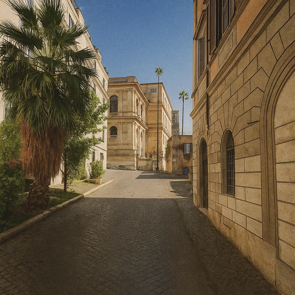
Piazza dell’Esquilino sits quietly on one of Rome’s historic hills, a place shaped more by everyday life than by grand gestures. Mornings bring the market, the mix of languages and faces, and the sense of a neighbourhood that has always been a crossroads. Just steps away stands the Papal Basilica of Santa Maria Maggiore — one of the city’s oldest churches, where early Christian mosaics share the same space with later baroque additions. The famous story of snowfall in midsummer, marking the outline of the future basilica, is still told here in a calm, matter-of-fact way, like an old local memory rather than a miracle to impress visitors. And around these streets, people long whispered about cardinals staying in private residences, about merchants who knew political news before it reached the palaces — small, authentic pieces of Rome’s urban life. It’s a corner of the city where history feels close, but never theatrical.

Before you reach the imposing façade of Basilica di Santa Maria Maggiore, you’re walking along Via Merulana. This street links the basilica with Basilica di San Giovanni in Laterano and was laid out in the late 16th century under popes Gregory XIII and Sixtus V. Its name comes from the Merula family, which once held the land here in medieval times. At the corner with Via Carlo Alberto, you’ll find the quieter and much older Basilica di Santa Prassede — originally founded in the 5th century, rebuilt by Paschal I around 817-822 to house relics of Saint Praxedes and Saint Pudentiana. Inside Santa Prassede, you’ll see 9th-century mosaics, notably in the Chapel of St Zeno, that show how early Christian Rome blended art and faith. Walking here feels like moving from the civic face of Rome toward a more hidden religious mesh — streets, basilicas, names all layered with meaning and history, not just monuments but the living city.

This corner of Esquilino brings together layers of Rome that usually never meet — an ancient hydraulic monument, a baroque experiment in alchemy, and a grand 19th-century square designed for the capital of a new Italy. Those massive brick walls are the remains of the Trofei di Mario, part of a vast water distribution complex built around 226–235 CE under Emperor Alexander Severus. It was initially a monumental nymphaeum, fed by the Aqua Julia and Aqua Tepula aqueducts, and decorated with symbolic “trophy” statues. The statues themselves were later moved to the Capitoline Hill, but the structure survived because in the Middle Ages, the Colonna family turned it into a small fortress. Nearby, inside the garden, stands the strange and fascinating Porta Magica. It once belonged to the villa of Massimiliano Palombara, a 17th-century Roman nobleman who was deeply involved in alchemical studies. The inscriptions in Latin and Hebrew are authentic formulas and symbols used by early modern alchemists. According to one popular story, the markings preserve the last notes of an anonymous alchemist who allegedly vanished after leaving behind traces of gold. Whether true or not, the gate was understood as a symbolic passage to hidden knowledge — and that’s how it earned the name “Magic Gate.” All of this sits inside Piazza Vittorio Emanuele II, an enormous square laid out between 1870 and 1887 after Rome became the capital of unified Italy. Its architecture follows the fashion of the time: broad arcades, large residential blocks, and a central garden planned as a modern urban space with a hint of romantic “ruins.” In one spot, you have a Roman waterwork, a medieval stronghold, a baroque curiosity, and a patriotic 19th-century square — woven together in a way only Rome manages to make feel natural.

Here’s the story of Pasticceria Regoli—a small but beloved spot in Rome’s Esquilino hill district, where baking meets history and everyday elegance. Founded in 1916 by the Regoli family, this pastry shop has quietly become a Roman institution. The surroundings of Esquilino matter: this hill—one of the city’s seven—once lay partly outside the ancient walls, was a zone of gardens, burial grounds, and later urban development, so a pastry shop here blends the local rhythm with deep roots in the city’s evolving story. What to try: their signature maritozzo with cream – a soft brioche bun filled with generous whipped cream. It channels a working-class breakfast turned modern classic. And in the photo, you see the tart topped with wild strawberries (fragoline di bosco) – that one is a real treat when it’s in season: crisp base, rich custard, fresh berries lightly dusted with sugar. Both desserts embody different facets: traditional simplicity and seasonal flourish.

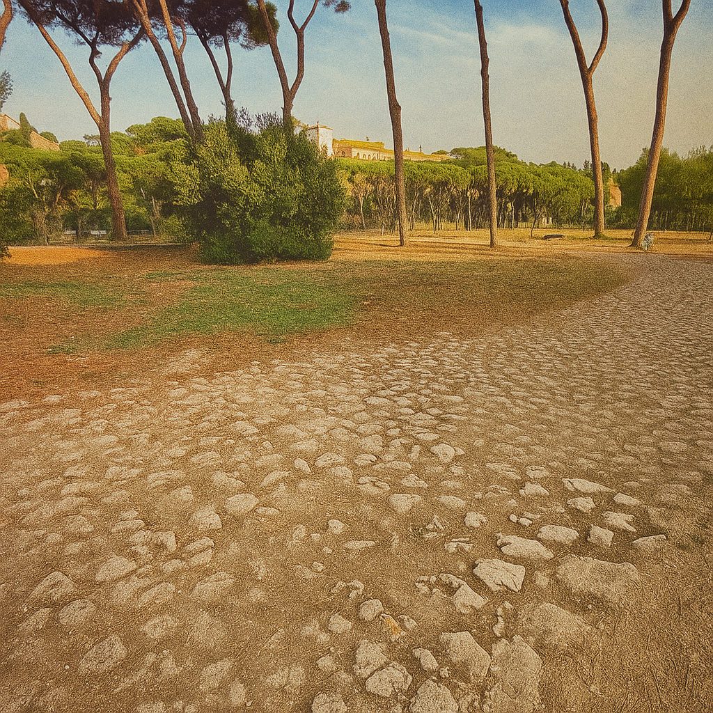
Colle Oppio looks like a simple park at first glance, but the ground here is resting on the remains of one of ancient Rome’s most ambitious projects — the Baths of Trajan. The curved wall in your photo is part of the massive halls designed by Apollodorus of Damascus, the same architect behind Trajan’s Forum and Market, built around 104–109 CE. The story of this hill starts earlier. This was once a wing of Nero’s Domus Aurea, the extravagant palace he built after the fire of 64 CE. After Nero’s death, the palace became a symbol of excess, and successive emperors wanted to erase that legacy. Vespasian drained the artificial lake and built the Colosseum there; Trajan went further and covered part of the palace, placing public baths on top — a political gesture as much as an architectural one: taking private luxury from an emperor and giving the space back to the people. For centuries the baths served as a social hub. Senators, craftsmen, poets, and travelers all passed through these halls. Later everything collapsed, overgrew, and slipped into semi-ruin. In the Renaissance, artists descended into the buried rooms of the Domus Aurea to study the ancient frescoes — Raphael and his circle traced these motifs, giving rise to what we now call the grotesque style. By the 19th and 20th centuries Colle Oppio was reshaped into a public park: paths, trees, a calm green space overlooking the Colosseum, shared by residents of Esquilino and Monti. Yet even today, every corner still sits on layers of imperial history — cycles of building, decline, and rediscovery. And the blooming tree in your photo fits naturally into this rhythm: in Rome, new life always grows directly out of the ruins. As for the name Colle Oppio, it’s thought to come from the ancient Roman family Oppia, who owned land on this part of the Esquiline Hill. Over time the area became known simply as the “Oppian Hill,” one of the three traditional spurs of the Esquiline.

The basilica known as Basilica di San Pietro in Vincoli was founded in the 5th century (around 432-440 AD) by the Empress Licinia Eudoxia to house a relic: the chains with which Saint Peter was bound in Jerusalem.
The name ("in Vincoli" = "in chains") comes directly from those chains, celebrated in a legend that their two separate sets — one from Jerusalem, one from Rome's Mamertine Prison — miraculously fused when compared.
Over the centuries, the church was rebuilt and remodelled: major renovations under Pope Julius II in the early 16th century and later under various architects.
Inside the central nave, you'll find a coffered ceiling whose central oval hosts a fresco by Giovanni Battista Parodi from 1706 titled "Miracle of the Chains".
The scene depicts Pope Alexander III healing Saint Balbina's neck by touching the chains of Peter — a narrative meant to celebrate the relic's power and the basilica's sacred status. Among other treasures, the basilica houses the famous sculpture of Moses ("Moses" by Michelangelo) by Michelangelo Buonarroti, created for Pope Julius II's tomb. Urban legends here include the miraculous merging of Peter's chains and Michelangelo striking Moses' knee, commanding "speak!" after sculpting it.
Opening hours: Monday–Saturday 07:30-12:20 and 15:00-17:50 (winter hours) according to the official site. lateranensi.org
Website: lateranensi.org/sanpietroinvincoli lateranensi.org
Entrance: No regular ticket fee (entry is generally free); donations welcome.
What makes Via della Polveriera interesting is not the building itself, but the history that runs beneath and around it. The street descends along the slope of Colle Oppio between Largo della Polveriera and Via del Fagutale, right in the Monti district. Its name comes from the gunpowder depots that stood here from the 17th century onward — storage sites serving the Roman garrison and later the Napoleonic troops. In 1694, one of these depots exploded, a blast strong enough to be remembered for generations as a reminder of how dangerous such warehouses were inside the city’s core. A quieter but equally fascinating layer lies beneath the pavement. In the late 19th century, archaeologists uncovered a fragment of the Forma Urbis, the massive marble map of ancient Rome, right near the modern stretch of Via della Polveriera. Excavations along the Colle Oppio slope continue to reveal details of the ancient landscape between Trajan’s Baths and the old Fagutal quarter — a reminder that even ordinary streets in Rome sit on centuries of hidden topography.

When you look at the Colosseum from here, it seems like the usual picture-postcard view — but only until you remember everything that lies underneath this part of Rome. This slope once marked the edge of Nero’s private estate, the Domus Aurea, before the land was reclaimed for the public. Long before the amphitheatre was built, this whole area was taken up by Nero’s artificial lake — a vast body of water created purely to amplify the scale of his palace. It was the kind of gesture only an emperor could make: putting a “sea” in the middle of the city. When Nero fell, the Flavian emperors used the geography against his memory. Vespasian drained the lake and placed the new amphitheatre right on top, turning a symbol of personal excess into a public monument. Archaeologists still find traces of the lake’s old edges beneath the northeastern side of the Colosseum — bits of the retaining walls that shaped the shoreline. So this isn’t just a grand ruin; it’s a place where the landscape itself was redesigned to make a political point. The whole district shifted around the new amphitheatre. To make room for crowds, the slopes of Colle Oppio were reshaped, streets were widened, and part of Nero’s buried palace was filled in so Trajan’s Baths could stand securely above it. The transformation of this hillside was one of the Flavian dynasty’s most significant urban projects. Another detail people rarely know: the Romans didn’t call it the Colosseum. For centuries, it was simply the Flavian Amphitheatre. The nickname “Colosseum” likely came later from the giant bronze statue of Nero — the Colossus — that once stood nearby. Even the name carries a faint echo of the ruler everyone tried to erase. And the building’s life didn’t stop with the games. In late antiquity, it hosted ceremonies and public gatherings; in the Middle Ages, it became a fortress for the Frangipani family; later, its stones were reused in houses and churches across Monti. From this viewpoint, it may seem like a solitary monument. Still, it’s deeply tied to everything around it: the buried halls of the Domus Aurea on Colle Oppio, Trajan’s Baths above them, and the everyday streets that still follow the old imperial topography. Rome constantly rewrites itself, and the Colosseum stands right where several of those versions meet.

The Nymphaeum of the Palatine doesn’t hit you with the same force as the Colosseum, but once you know where you’re standing, the whole place becomes part of a much larger story. It sits on the lower edge of the Palatine Hill, the hill of emperors — the place where Augustus, Tiberius, and Domitian shaped their power not only through buildings, but through the landscape itself. The fountain you see — with its curved apse, niches and water channels — was part of a pleasure garden attached to one of the imperial palaces, probably from the Severan period in the 3rd century. It wasn’t just decoration. Nymphaea in Rome played a symbolic role: water, greenery, cool air, and mythological imagery turned imperial spaces into controlled “nature,” a kind of staged paradise at the foot of the rulers’ residence. And this is where the geography matters. The Palatine looks down onto the Forum on one side and toward the Circus Maximus on the other, but it also links — quietly, almost invisibly — to the slopes of the Caelian and Oppian hills. These three hills formed a kind of triangle of imperial presence: the palaces on the Palatine, the great bath complexes on the Oppian (like Trajan’s), and the elite residences on the Caelian. Water systems, garden terraces, and stairways connected them all. The NymNymphaeumts into this network. It stood along a route that linked the private world of the Palatine with the public world below. From here, emperors could descend toward the valley or walk along garden paths toward the Caelian. In a city built on seven hills, power wasn’t just shown in monuments — it was demonstrated in how those hills were stitched together. One quiet detail: the fountain still carries traces of its original marble facing, and archaeologists have found pipes that fed it directly from the aqueduct lines running toward the Caelian. It’s a reminder that even the most serene corner of an imperial garden was engineered with precision. So when you stand in front of this Nymphaeum, you’re not just looking at a pretty ruin. You’re standing at a seam between hills — a place where Rome’s topography, its water, its palace gardens, and its political theatre all met. The Palatine above, the Caelian beside it, the Oppian facing it — three hills talking to each other across time.
What you’re looking at is one of those Roman details that almost disappears under your feet: an old stone path climbing the Palatine slope, a fragment of the circulation system that once stitched together the palaces, gardens, and service areas of the imperial hill. It rises from the area of the Palatine Nymphaeum. It moves upward toward the Nymphaeum of the Cistern and eventually to the Stadium of Domitian, which sits like a private racetrack on the hilltop. This path wasn’t a grand ceremonial road — it was part of the practical, everyday infrastructure of the Palatine. Enslaved people, gardeners, attendants, and officials used routes like this to move between terraces, water installations, and the secluded spaces of the imperial residences. And this is where the Palatine shows its true nature. Each emperor might have added new wings, new fountains, new halls, but the hill itself held everything together. The Palatine wasn’t one palace — it was an entire landscape engineered into levels: nymphaea for display, cisterns for water storage, ramps and paths for circulation. This rough stone pavement is a surviving trace of that system. It’s the “backstage corridor” of imperial Rome. The slope you’re walking up links three essential elements: • the lower pleasure gardens, fed by aqueduct water and cooled by fountains; • the service heart of the hill, where cisterns and channels controlled the water supply; • the emperor’s private stadium, a long garden space used for walks, exercises, and formal receptions. What makes this little path special is how quietly it bridges those layers. You’re literally walking the same gradient that palace workers used when the Palatine was the centre of the empire. The seven hills of Rome were never isolated humps of land — they were connected by movement, by water, by sightlines. And here, on this weathered stone road, that interconnected landscape is still visible. From the nymphaeum at the base to the stadium at the summit, this path is a reminder that Rome’s power was not only in its monuments but in the way its hills were shaped, linked, and made to work together.
The nymphaeum and its adjoining cisterns on the Palatine form a functional part of the hill's ancient water system, supplied by branches of the Aqua Claudia that fed imperial gardens and fountains. The cisterns served as settling chambers, where water was collected and clarified before distribution, and the nymphaeum marked the transition from utility to display — a point at which stored water became part of the palace landscape. Their position on the southern slope reflects the Palatine's terraced design, with service structures below and representative spaces above, including the nearby stadium of Domitian. These installations show the practical side of the imperial hill: the technical infrastructure that allowed the palaces, gardens and decorative water features to operate seamlessly.
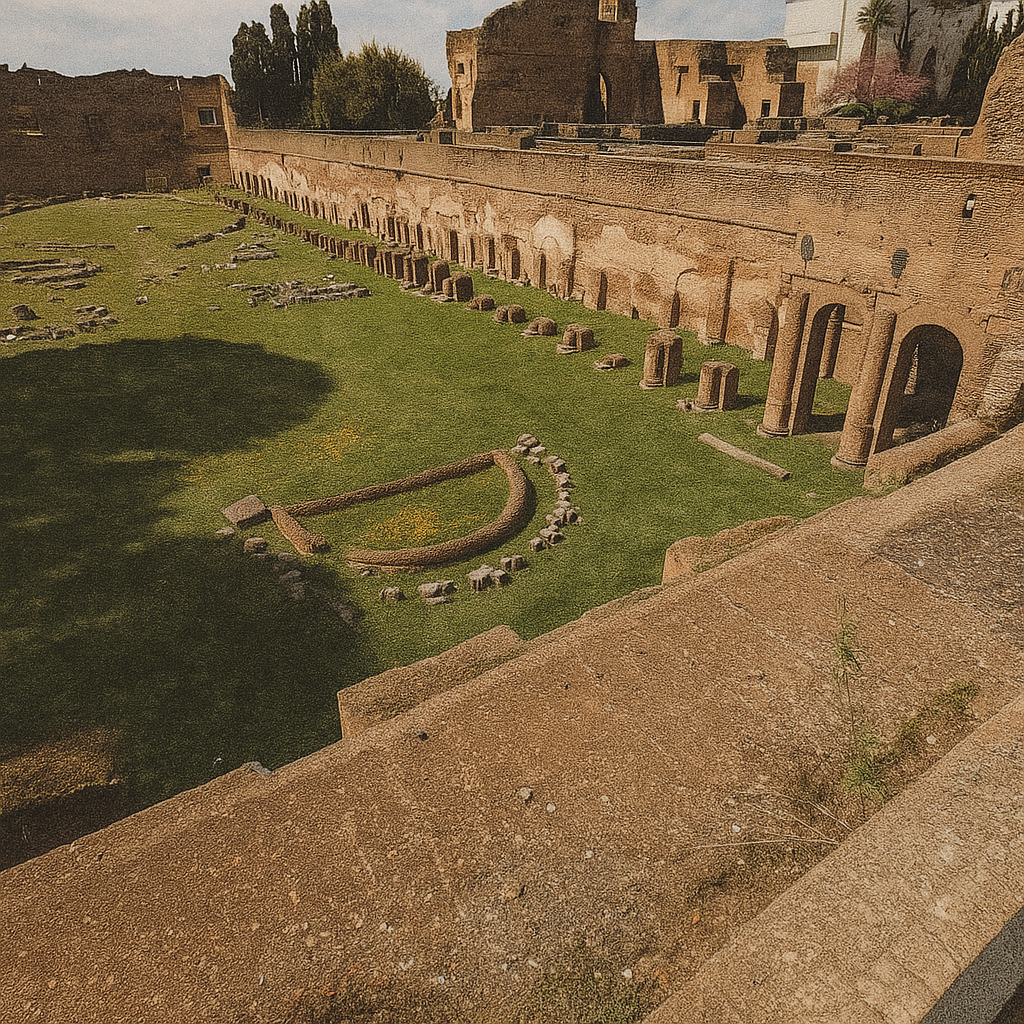
The Palatine Stadium was built into the eastern wing of Domitian’s palace at the end of the 1st century CE. It wasn’t meant for races but for the emperor’s private use — a long garden arena with fountains, sculptures and seating, designed for ritualised walks, small ceremonies and controlled displays of imperial presence. In the following centuries, it shifted roles: part of the Severan palace gardens, later a service zone under Constantine, then a fortified area in the Middle Ages, and finally a foundation for the Farnese gardens, which reshaped its terraces in the Renaissance. Medieval traditions mention processional use, while Renaissance antiquarians recorded statue fragments found here and added them to elite collections. Figures like Fulvio, Marcantonio Sabellico and artists from Raphael’s circle studied the ruins as they re-emerged from the soil.

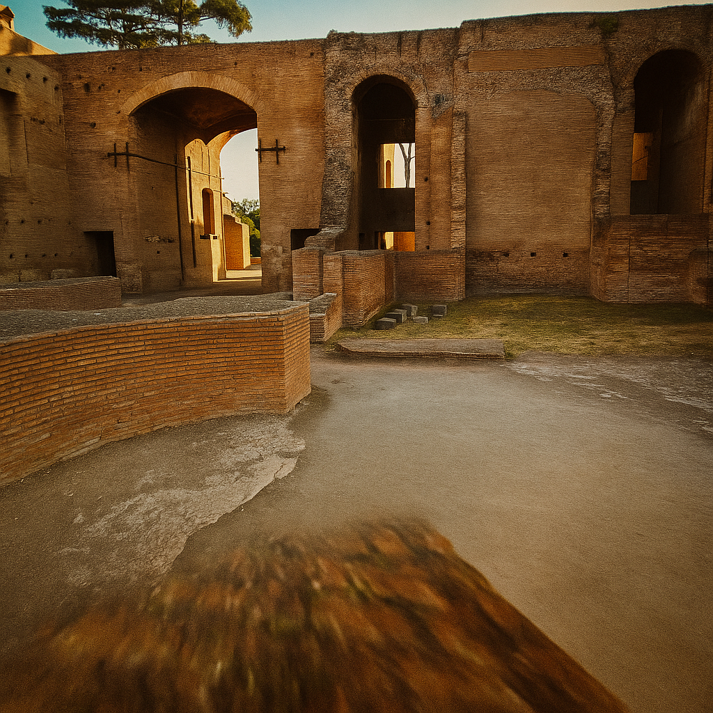
The **Baths of Maxentius** were part of the building program of Emperor Maxentius in the early 4th century along the Via Appia. They followed the standard structure of Roman baths—frigidarium, tepidarium, caldarium and pools—but on a smaller, more private scale than the large imperial complexes of earlier centuries. The **Domus Severiana**, on the southeastern edge of the Palatine Hill, was built in the early 3rd century under the Severan dynasty as an extension of the imperial palace. It included terraced halls, garden platforms and its own bath facilities, serving both official and residential functions for the Severan emperors. Roman bath culture combined bathing with exercise, socialising and leisure; water came through aqueducts, and hypocaust systems provided heating. After the fall of the empire, these structures gradually lost their function: parts became fortifications, storage spaces or sources of building stone in the Middle Ages, and later merged into gardens and farmland. Their names derive from Emperor Maxentius and the Severan dynasty.
The Fountain of the Pelte on the Palatine is the modern name for a fragmentary nymphaeum decorated with shield-shaped reliefs (*peltae*), a motif associated with Dionysian imagery and palace garden décor of the Julio-Claudian and Flavian eras. It belonged to the water-display system of the imperial residences and likely dates to the 1st century CE, functioning both as a cooling element and as part of the ornamental program of the palace terraces.
The **Aula Isiaca** is an underground hall with Egyptianizing decoration from the late Republican or early Augustan period. Its name comes from the wall paintings inspired by the cult of Isis — a fashion among elite Romans who associated Egyptian imagery with luxury and esoteric prestige. It was later incorporated into the Renaissance *Loggia Mattei*, when the Mattei family reused the surviving ancient structure and added an open loggia above it.
The **Domus Augustana**, built under Emperor Domitian in the late 1st century CE and designed by his architect Rabirius, formed the private wing of the vast Palatine palace complex. Its courtyards, audience halls and private apartments formed the administrative and residential core of imperial power for centuries. After the 3rd century, the complex was modified by the Severan emperors; by late antiquity, parts were repurposed as service quarters and administrative offices. In the Middle Ages, the ruins became part of fortified enclosures controlled by Roman noble families; in the Renaissance, many areas were absorbed into the Horti Farnesiani. These spaces appear in archaeological literature and modern documentaries but have no major film depictions; surviving legends relate mainly to the Isis hall, which early antiquarians misinterpreted as a sanctuary rather than a decorative room. Together, these structures reflect the evolution of Palatine architecture from Republican elite houses to the formalised palace of the emperors and its later transformations.

From this lookout on the Palatine Hill the city unfolds in clear chronological layers. The octagonal structure in the foreground is San Teodoro al Palatino, a 6th-century early Christian rotunda that stands on top of what were once service buildings belonging to the ancient Forum. Behind it runs the edge of the modern city — the residential fronts of Via dei Fienili and Via San Teodoro, where contemporary Rome meets the archaeological zone. Further to the right are the towering remains of the Basilica of Maxentius, the last and largest hall ever built in the Roman Forum. Its arches, when complete, rose higher than the Colosseum and defined the skyline of late imperial Rome. On the horizon shines the massive white silhouette of the Vittoriano, the national monument dedicated to Victor Emmanuel II. It marks the moment when Rome became the capital of unified Italy and stands beside the bell tower of Santa Maria in Aracoeli and the medieval structures of the Capitoline Hill. Between all these landmarks lie the domes and churches stitched into the Forum’s landscape — Santa Maria di Loreto, Santi Luca e Martina, and others that grew out of the ruins in the centuries after the empire collapsed. This entire panorama covers the ground of the Roman Forum and the Imperial Fora — the heart of political power, religion, administration and ceremony in ancient Rome. In antiquity the view would have been filled with temples, basilicas, the Senate house, victory arches and sacred routes. In the Middle Ages these same spaces became the Campo Vaccino, a rough pasture where ruins stood half-buried. In modern times excavations reopened the ancient terrain, revealing the layering that defines this view today. Seen from here, Rome’s history becomes legible in a single glance — the early city, the imperial capital, the medieval town, the Baroque churches and the modern nation all standing in one continuous landscape.
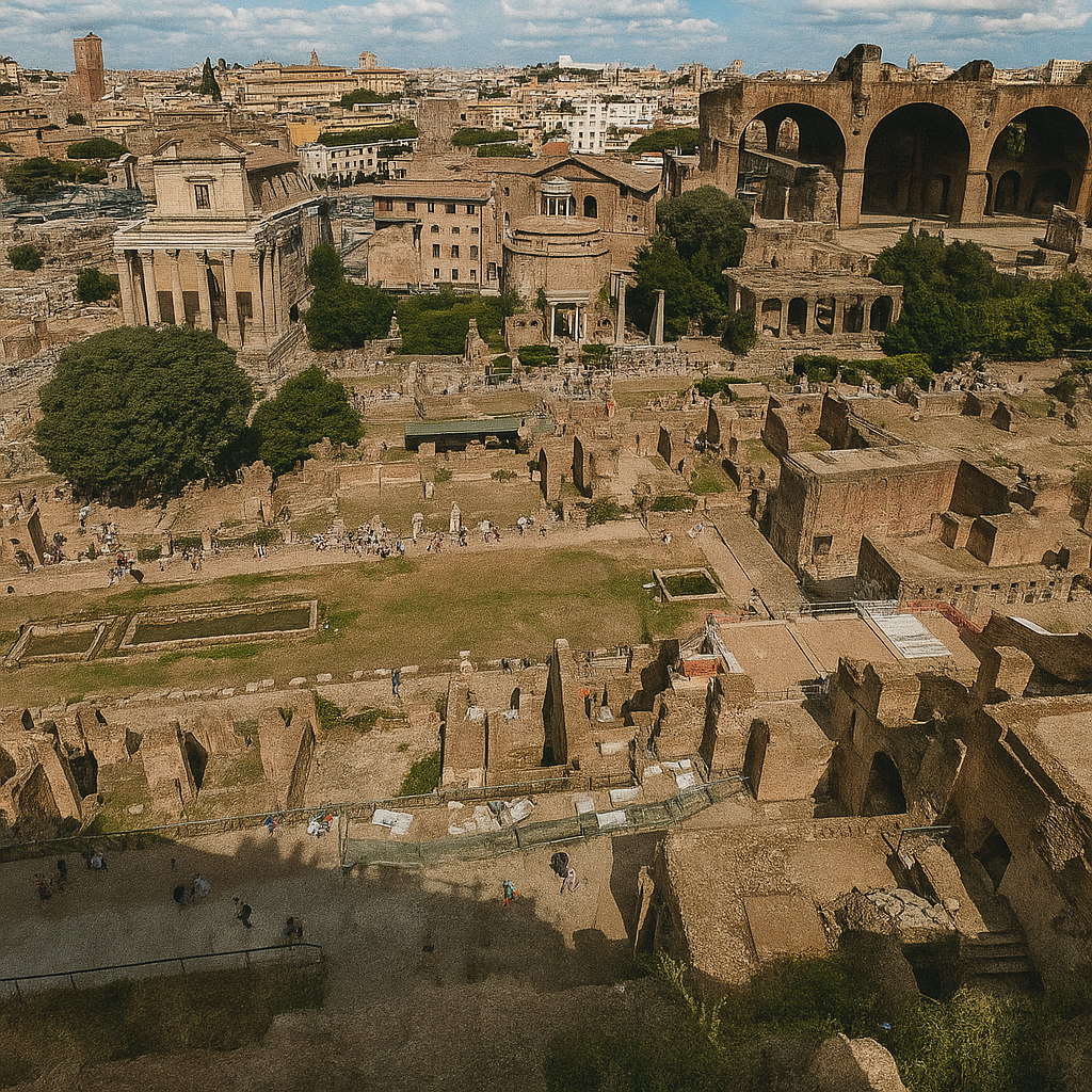
Palatine View – identifying each structure and its history in one narrative
Lower Palatine service and residential blocks Visible at the bottom of the photo are broken walls and corridors below the garden. Built under Domitian (81–96 CE) as the logistical base of the imperial palace: storerooms, staff quarters, supply corridors. After the empire collapsed, these rooms became stables and storage huts. Domitian died in a palace conspiracy, but his architectural framework defined the entire hill.
Peristyle courtyard with two long basins (Domus Flavia) Seen in the centre as a long rectangular garden with two shallow water channels. Created by architect Rabirius for imperial receptions. Delegations from the provinces were received here. The water cooled the courtyard and reflected incoming light. It functioned as a ceremonial stage for the Flavian dynasty.
Palatine terrace substructures Visible as massive brick arches on the lower right. These engineering platforms supported the palace's artificial terraces, built in the late 1st century CE. The design comes from the Flavian building program. In the Middle Ages, the same vaults served as foundations for fortified structures.
Church of San Lorenzo in Miranda (Temple of Antoninus and Faustina) Visible in the middle of the scene as a round, domed building. Beneath it stands the temple built in 141 CE by Antoninus Pius for his deified wife Faustina. Antoninus was one of Rome’s most stable rulers. In the Middle Ages, the temple became a church, which preserved the ancient walls and podium.
Temple of Saturn Seen as a group of columns left of the domed church. Originally from the 7th–6th c. BCE, rebuilt several times. It housed the state treasury (*aerarium*). The treasury was looted during the sack of Rome in 410 CE. Saturn symbolised Rome’s “golden age,” and the temple stood at the foot of the Capitoline.
Temple of Vespasian and Titus Visible as three isolated Corinthian columns to the right of the Temple of Saturn. Built by Domitian in the 80s–90s CE to honour his father Vespasian—restorer of order after 69 CE—and his brother Titus, conqueror of Jerusalem and inaugurator of the Colosseum. The temple was a dynastic memorial to the deified Flavians.
Basilica of Maxentius Seen on the right upper side are enormous surviving vaults. Begun by Maxentius (308–312 CE) and finished by Constantine after defeating him. Constantine replaced Maxentius’s colossal statue with his own. It was the largest roofed hall in the Forum, with arches rising over 35 meters.
Slopes of the Via Sacra Visible as green strips between the temples and the basilica. This was Rome’s main ceremonial route. Triumphs of Caesar, Augustus, Trajan and Titus passed here. In the Middle Ages, it became a simple path through pastureland but retained its ancient line.
Ruins of tabernae, shrines and workshops Seen in the centre are tightly packed low brick walls. These were shops, small sanctuaries, administrative rooms and artisan spaces. Financial transactions, lending and everyday commerce took place here. Archaeologists have found graffiti with political jokes from the late Republic.
Background districts of Monti and Centro Storico Visible on the horizon is the modern city behind the Forum. These quarters evolved from the medieval and Renaissance neighbourhoods built atop ancient Subura. In the 20th century, Monti became associated with artisans, small theatres and early film actors from Cinecittà.
Path descending from the Palatine Seen at the very bottom edge as the walkway running across the frame. This modern visitor route follows the line of an ancient service road that brought water, food, and fuel into the imperial palace. It remained in use through late antiquity, the Middle Ages, and into the 19th century.
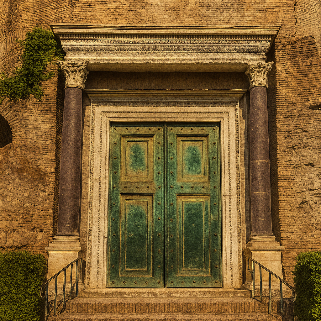
The building in the photo is commonly mistaken for a shrine to Rome's legendary founder, but it has nothing to do with that Romulus. It is the Temple of Romulus, the son of Emperor Maxentius, built around 307–309 CE during one of the most chaotic moments of the late Roman Empire. At that time, five men simultaneously claimed the title of emperor and fought for control. Maxentius, who ruled from Rome, used the temple as a political statement. By dedicating a monument to his young son, he tried to project an image of dynastic legitimacy that he never truly possessed. The entrance you see — framed by deep-purple porphyry columns — preserves one of the rarest survivals in the Forum: its original bronze doors, almost intact after seventeen centuries. The round hall behind them reflects the typical brickwork and proportions of late-imperial architecture. After Constantine defeated Maxentius at the Battle of the Milvian Bridge in 312 CE, the temple quickly lost its purpose. But the structure was so solid and conveniently positioned that it was incorporated into the vestibule of the Christian basilica of Saints Cosmas and Damian, the first major church to be established directly inside the Roman Forum. A pagan shrine built by a doomed ruler for an undistinguished child became the entrance to a Christian sanctuary — one of the striking ironies of late Roman history. The adjacent structure — the so-called "Carcer" Next to the temple stands a small block long known as the Carcer ("the prison"). The name is misleading. It appeared in the 18th–19th centuries, when the area was poorly understood and archaeologists often assigned functions based on guesswork. Modern research shows that the building contained service rooms — storerooms or administrative spaces from the late imperial period, likely also dating to Maxentius's building program. In the Middle Ages, the structure was incorporated into the basilica's monastic complex and later used as part of its functional spaces. No prisoners were held here, no executions took place, and no ancient sources connect it with judicial activity. Its history is a reminder that names in the Forum often outlive the facts and must be corrected as archaeology advances.

In this place, the Roman Forum unfolds as a sequence of overlapping eras. At the bottom, the broken marble steps and podium fragments mark the remains of ancient platforms where speakers addressed crowds, magistrates held hearings, and processions passed through. On the right edge, you can see the base of the Column of Phocas, while the large white structure in the centre-left is the Arch of Septimius Severus. Behind it rises the baroque dome of Santi Luca e Martina, and further up the slope, on the Capitoline, a piece of the Vittoriano glows in white marble. Arch of Septimius Severus The triple arch dominates the frame, built in 203 CE to celebrate the victories of Septimius Severus and his sons Caracalla and Geta in the Parthian campaigns. Severus, originally from Lepcis Magna in North Africa, rose to power through civil war and founded the Severan dynasty, which reshaped imperial politics by placing the army at the centre of authority. The reliefs carved into the arch depict Roman sieges, captured cities and military parades returning from the East. The inscription once included Geta's name, but after Caracalla murdered his brother and imposed damnatio memoriae, Geta's name was chiselled out. The erased letters are still clearly visible today. In antiquity, the arch marked the symbolic transition from the Forum toward the Capitoline. In the Middle Ages, when the Forum sank into a landscape of farms and pastures, it became one of the few structures still visible above ground and served as an orientation point for the surrounding settlement. Column of Phocas To the right stands the base of the Column of Phocas, the last official monument ever erected on the Forum, dated to 608 CE. The column itself is a reused imperial shaft from an earlier period, repurposed by the Byzantine authorities. Phocas, the emperor honoured here, was widely despised — a ruler whose years in power were marked by political purges, heavy corruption and military failures. Yet this monument was not meant to celebrate him in Rome. It was a diplomatic gesture to Pope Boniface IV, carried out as part of negotiations that led to the Pantheon's conversion into a Christian church. Because this column was the last late-imperial installation on the Forum, it marks the moment when the ancient civic centre of Rome definitively slipped into the medieval world. Santi Luca e Martina The baroque church behind the arch, with its characteristic dome, occupies the area once known as the Secretarium Senatus — the hall used for Senate meetings during the final centuries of the Roman Empire. The current church was designed in the 17th century by Pietro da Cortona, one of the leading figures of Roman Baroque. He served as the head of the painters' guild, the Accademia di San Luca, and took personal responsibility for restoring and expanding the church. It is dedicated to St. Luke, patron of artists, and to the martyr Martina. Pietro da Cortona himself asked to be buried here, and his tomb still stands inside. Architecturally, the church sits exactly where the political chamber of late antiquity once operated, making its dome a visual marker between two worlds — the administrative Rome of the emperors and the artistic, ecclesiastical Rome of the Baroque age. The Capitoline and the Vittoriano On the left horizon is a fragment of the Vittoriano, the massive 19th-century monument to Victor Emmanuel II. Although separated from the Forum by more than a millennium, it aligns itself deliberately with Rome's ancient core, embodying the modern Italian state's desire to anchor its identity in the city's classical past.
