This final chapter of Susita's story is what transformed it from a dangerous, besieged outpost into the peaceful archaeological park you see today. Between 1948 and 1967, the atmosphere here wasn't one of historical wonder, but of constant, grinding tension.
1967: The Breakthrough from the Abyss 1. The "Underdog" Position Before 1967, the military situation here was a nightmare for the Israeli soldiers stationed on the hill.
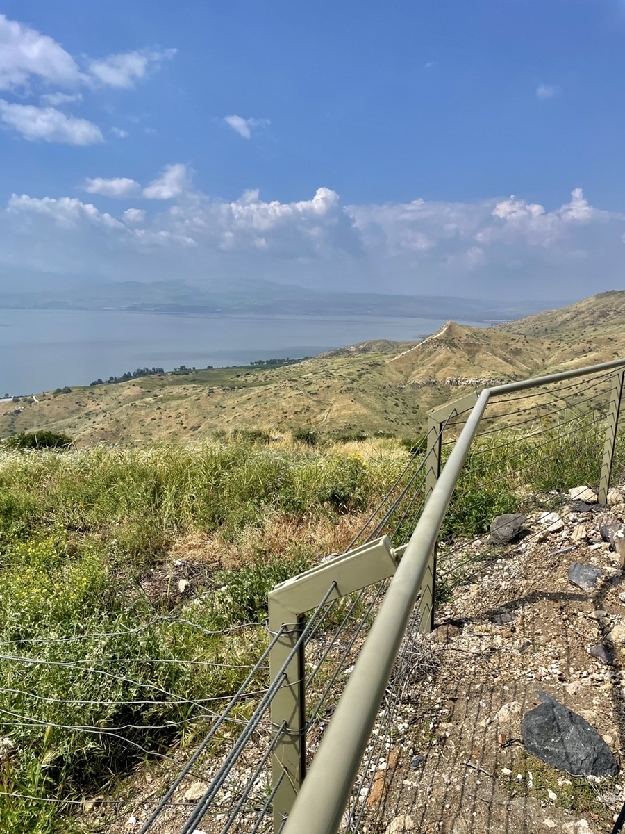
The High Ground: Even though the Israelis held Susita, the Syrian army held the much higher Golan plateau (where Kibbutz Afik and Kfar Haruv stand today).
The Sniper's View: From their positions above, the Syrians could see every single movement on Susita and every boat on the Kinneret. Susita was the "eyes" for Kibbutz Ein Gev below, but it was constantly under surveillance from above.
- The Firestorm When the Six-Day War broke out in June 1967, Susita took the full force of the conflict.
The Shelling: Syrian artillery from the surrounding heights literally "ploughed" the plateau. The soldiers you saw in those old photos had to stay deep inside their basalt-reinforced bunkers to survive the barrage.
The Landscape Barrier: Because there were no proper roads leading up the steep western slopes, it was impossible to bring up tanks or heavy armour. Susita was an island of infantry in a sea of fire.
- The Turning Point (June 10, 1967) The assault on this sector began later than the one in the northern Golan.
The Strategy: Israeli forces (primarily the 80th Paratrooper Brigade and the Carmeli Brigade) didn't just charge straight up the cliffs. They used Susita as a pivot point.
The Air and Ground Move: While infantry scrambled up the mine-filled, wire-tangled slopes, paratroopers were dropped by helicopters behind the Syrian lines on the Golan plateau.
The Collapse: By the evening of June 10, the Syrian positions (such as the one at Muzil overlooking Susita) were neutralised. The Syrian army began a rapid retreat toward Damascus.
- From Frontline to Backyard In a single day, the status of this mountain changed forever.
Peace in the Valley: For the first time in 19 years, the people in the kibbutzim below (Ein Gev, HaOn) could turn off their searchlights and sleep without fear of shelling.
The Archaeologists Arrive: The mountain went from a "closed military zone" to a historical treasure chest.
It's a powerful thought: the reason we can stand here today and calmly debate the beauty of a Corinthian capital is because of that frantic, violent 24-hour period in 1967 that pushed the front line miles away from this cliff.
Imagine the perfect spring morning in Israel—the sun is warm but not yet "blasting" you, and the air smells like fresh wildflowers. It's the absolute best time to grab the keys and head to the eastern side of the Kinneret (Sea of Galilee).
First Stop: Kursi & The Views Start your day at Kursi. It's this massive Byzantine monastery ruin where the vibe is just... super chill. You can walk across ancient mosaics and literally feel the history. But don't stay too long because the drive up the mountain is even better. Make sure to pull over at Mitzpe Nukieb. On a clear day, the view is insane—you see the whole blue "bowl" of the Kinneret stretched out from Tiberias to the Golan Heights. It's one of those "stop and just stare" moments.
The Main Event: Susita (Hippos) Then, you've got the crown jewel: Susita. It's like a ghost city sitting on a hill. They call it the "Pompeii above the lake." You'll walk through the old Roman forum and see giant columns that were knocked down by an earthquake 1,200 years ago and just... stayed there. It's got this wild mix of ancient Roman vibes and old Israeli military outposts.
Trains and Hummus When you head back down, swing by the old Tzemach train station. It's been restored and feels like a movie set from the early 1900s—back when trains ran all the way from Haifa to Damascus.
Finally, once you're officially "toured out," hit up Hummus Eliyahu at the Tzemach junction. Trust me, a warm bowl of creamy hummus with olive oil, fluffy pita, and a solid cup of coffee is the only way to end a trip like this.
Pro tip: Go right now while it's spring. The Golan is bright green, and everything looks like a masterpiece.